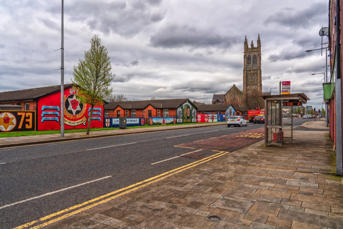
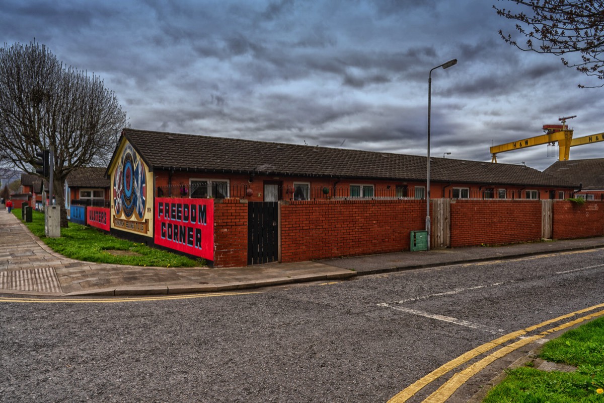
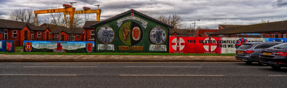
FREEDOM CORNER NEWTOWARDS ROAD PHOTOGRAPHED 2019
Freedom Corner on the Newtownards Road in east Belfast features a number of political murals. The murals have been there for close to forty years.
The A20 is a road in County Down in Northern Ireland. It runs from Belfast to Newtownards and on to Portaferry.
Beginning as the Newtownards Road at the junction of Bridge End close to Belfast city centre, the road runs in an easterly direction through east Belfast. The early parts of the road are mainly working-class Protestant districts with strong links to the nearby Harland & Wolff shipyard. After the junction of the Holywood Road, it becomes the Upper Newtownards Road and enters the middle-class areas of Ballyhackamore, Knock and Stormont, where it passes the Parliament Buildings.
After leaving Belfast and passing through Dundonald, the road becomes a dual carriageway, passing through a mainly agricultural area before arriving in Newtownards.
After Newtownards, the road follows the Strangford Lough shore to Portaferry, close to the end of the Ards Peninsula. Here, a ferry service is available to Strangford. In Portaferry the road joins the A2 coast road.
You will find links to buy products from Amazon, Google and other partners. If you click on these links, you’ll find that the URL includes a small extra piece of text which identifies that the click came from my websites. This text is an affiliate code, and it means that I get a small percentage of the money you spend if you choose to buy that product, or, in some cases, other products from the site soon after. These affiliate links help pay the costs of producing my websites and ensure that the content is free to you.