JANUARY 2022HOPING FOR THE BEST YEAR EVER
JAMES JOYCE BRIDGEULYSSES WAS PUBLISHED 2 FEBRUARY 1922
The James Joyce Bridge is a road bridge spanning the River Liffey in Dublin, Ireland, joining the south quays to Blackhall Place on the north side.
Designed by Spanish architect Santiago Calatrava, it is a single-span structural steel design, 40 m (131 ft) long. The deck is supported from two outward angled arches, the silhouette of which is sometimes compared to the shape of an open book.
The bridge was built by Irishenco Construction, using pre-fabricated steel sections from Harland and Wolff of Belfast.
The bridge is named for the famous Dublin author James Joyce, and was opened on 16 June 2003 (Bloomsday). Joyce's short story "The Dead" is set in Number 15 Usher's Island, the house facing the bridge on the south side.
In the spring of 1921, Paris bookseller Sylvia Beach boasted about her plans to publish a novel she deemed a masterpiece that would be "ranked among the classics in English literature".
On 2 February 1922, Beach published the first book edition of Ulysses, just in time for Joyce's 40th birthday.

MARROWBONE LANENEAR THE GUINNESS COMPLEX
I was unaware that there was a street or laneway named George's Hill near to where I live. In fact I thought thought that it was but a section of North Anne Street and to add to my confusion I have frequently photographed the Church Of St. George on Hill Street.
The street features a former school which was but one element of a cluster of buildings accommodating a school, convent, chapel and orphanage. The school was designed by John Burke, a Dublin architect who worked on a vast body of religious buildings. Its extension was designed by W. H. Byrne. Its recent (1992) adaptation to supported housing has successfully maintained its character including the generous timber sash windows. The window openings respond to the building form by emphasising the front gables with round arches and distinguishing between ground and first floor windows. The high level of the ground floor windows is typical of nineteenth-century school buildings ensuring ample daylight within while maintaining privacy and eliminating distracting views to outside. Together this cluster of buildings have an important social significance in the local area.

SOUTH RICHMOND AVENUE - DARTRY MILLTOWN LUAS TRAM STOP
I did not know that this is South Richmond Avenue or that it is in Dartry.
Dartry is a small suburb of Dublin often seen as part of the broad Rathmines area. Among the locations in Dartry are Dartry Road, Temple Road, Orwell Park and Palmerston Park.
In the part of Dartry Road between Palmerston Park and Temple Road is located Trinity Hall, one of the student residences of Trinity College Dublin. The side gate opening on Dartry Road is the main pedestrian entrance to the Trinity Hall grounds.
Also on the Trinity College grounds at Dartry is the latest (since 1967) home of the centuries-old Trinity College Botanic Garden.
The Dropping Well pub at the riverside is built on the site of a mortuary established to deal with dead bodies carried down the river to the pool underneath the nearby waterfall. It was later a well-known destination for "bona fide" travellers who had to have gone more than 3 miles to be served a drink during the holy hour when Dublin pubs used to shut between 2.30 and 3.30 in the afternoon.
Dartry Road is known as the scene of the killing of IRA member Timothy Coughlin by police informer Sean Harling on the evening of 28 January 1928. It happened opposite 'Woodpark Lodge', where Harling lived at the time.
Máirtín Ó Cadhain the Irish author famous for writing Cré na Cille lived at 12 Sunbury Gardens.
Dartry House is an imposing two-storey mansion built about 1810 with several additions made later such as a turret which was incorporated in the building about 1900.
Its original owner was Obadiah Williams, a wealthy merchant of Huguenot origin. Among later owners was William Martin Murphy, who owned The Irish Independent, was involved with the Dublin United Tramways Company (DUTC) and was a central figure in the dispute known as the "Dublin Lockout" of 1913 where the union side was led by Jim Larkin. The DUTC constructed the tram line from the centre of Dublin to Dartry and Dartry House was built at the original place where the line ended. The terminus of the line and the associated sheds now house an engineering firm.

FINDLATER FAMILY VAULTMOUNT JEROME CEMETERY

May 30th 2019 Alex Findlater died following a riding accident in Punjab, India.
In 1823 Alex. Findlater & Co. began trading in Dublin. The company was founded by Alexander Findlater, a hard working spirit merchant. He set up his business on Burgh Quay opposite the Custom House. From humble beginnings, the business grew rapidly and extensively not just in Dublin but into the United Kingdom also, expanding into other fields; trading in Wines, Teas, Coffees and Groceries.
In Dublin, the Findlaters prospered. By 1906, the company had expanded into groceries, tea and provisions, with 14 shops. They built Findlater’s Church on Parnell Square, as well as the Todd Burns department store on Mary Street. Their Mountjoy Brewery, established in 1852, was Dublin’s second-largest exporter of stout by 1866. They also operated hotels in Howth and Bray.
ST NAHI'S IN DUNDRUM 18th CENTURY CHURCH AND GRAVEYARD
If you visit the graveyard be aware that as sections are in very poor condition it is easy to trip and fall.
The name Taney derives from Tigh Naithi meaning the house or place of Nahi, and who may also be associated with Tobarnea, a seashore well near Blackrock. The current church is still in use by the local Church of Ireland community and is one of two churches in the Parish of Taney (historically encompassing the whole area around Dundrum). It is built on the site of an early Irish monastery founded by Saint NahÍ.
St. Nahi's stands on the grounds of the original monastery, having been refurbished several times, most recently in 1910, after a period when it was in use as the parish boys' school. Following storm damage to the roof, a major refurbishment was carried out by the then Rector of the Parish, Canon William Monk Gibbon (father of the poet of the same name), who is buried in the grounds of the church. A plaque erected after the refurbishment reads:
The entrance gate to this Churchyard was erected by the parishioners of Taney Parish to the memory of William Monk Gibbons, Canon of Christ Church Cathedral by whose impression and effort the restoration of this church was accomplished. He repaired the altar of the Lord.
The church contains some interesting artefacts including the baptismal font of the Duke of Wellington who was baptised in 1769, donated to Taney Parish in 1914 by the closing of St. Kevin’s Church in Camden Row, and altar tapestries depicting scenes from the Bible. The tapestries illustrating the Last Supper were made by the two Yeats sisters Lily and Lolly Yeats, both of whom are interred in the graveyard.
Two Rathdown Slabs are displayed inside the church. These ornate burial slabs date back 1,000 years to the Viking-Christian era. Such slabs have only been found in the barony of Rathdown (the area roughly covering Churchtown to Bray). Only about 30 of these slabs have been discovered to date, these two were discovered in 2002 in the graveyard by archaeologist Chris Corlett, who had missed his bus from Dundrum and decided to explore the cemetery. Local historian John Lennon, as well as Harry Griffith, aided by Dúchas, relocated the slabs inside the church. Harry Griffith has been researching and listing the graves in St. Nahi's graveyard since 2001, compiling a comprehensive history and listing of the graveyard. Harry Griffith was interred in the graveyard after an illness on 18 April 2012.
An insight into life expectancy for the area can be gleaned from the "Index to the Register of Burials" for the parish between January 1897 and April 1917 show 1,836 people buried during this period, of which 551 were children under 6 years of age.
The organ of St. Nahi's was built by the renowned Irish organ-builder William Telford. However, St. Nahi's was not its original home. The organ was only installed there in the 1990s. The church used a harmonium (which is still there) to lead congregational singing. The organ has one manual, pedal of limited compass and seven stops.
Cremated remains are interred to the left of the entrance gates. This area was originally used for patients of the Dundrum Central Mental Hospital. Old records refer to this area as the Asylum Plot.
A back gate to the church was only recently uncovered under much overgrowth. Although it had been used by teachers as a shortcut between the Church (when it was being used as a boys' school) and the nearby girls' school, its original function is said to have been as an entrance for Roman Catholics when attending funerals at a time when they were barred from entering the main gates of a Protestant church.
Many Irish Republican graves lie within the graveyard, including the gravestones of Lorcain McSuibhne, a member of the Irish Republican Army killed in 1922 in Kildare (his funeral occurred at St. Nahi's and there exists photographic evidence of Éamon de Valera in attendance) and of James Burke, who was killed in Croke Park on Bloody Sunday.
The graveyard also contains many Royal Irish Constabulary Officers and Freemasons. There is one War grave. Sgt. William Anthony Kavanagh, RAF Volunteer Reserve, age 24, died 23 Sep 1944 as a result of a cycling accident while home on holiday, son of William and Mary Kavanagh of Balally. The site also contains the grave of the Irish physicist George Johnstone Stoney, who died in London in 1911. His ashes were brought back to be with his wife, mother and sister. His cousin Robert Stoney was a local curate when his wife died.
Currently over 10,000 burials have been recorded, with the earliest visible gravestone dating back to 1734. The Parish of Taney: a History of Dundrum, Near Dublin, and its Neighbourhood published in 1895, claims that there are "tens of thousands" of burials within the graveyard, a credible figure considering its age.
As the churchyard predates the disestablishment of the Church of Ireland in 1869, it is open for burial to all those who live within the boundaries of the Parish of Taney, whatever their denomination.

THE WILLIAM DARGAN BRIDGEDUNDRUM
William Dargan Bridge, opened in 2004, is a cable-stayed bridge in Dundrum, Dublin in Ireland. It carries the Luas light rail line (Green Line) across a busy road junction. The bridge connects rail alignments which were formerly part of the Harcourt Street railway line.
The bridge crosses the R112 and R117 regional roads as well as the little-known Slang River.
William Dargan (28 February 1799 – 7 February 1867) was arguably the most important Irish engineer of the 19th century and certainly the most important figure in railway construction. Dargan designed and built Ireland's first railway line from Dublin to Dún Laoghaire in 1833. In total he constructed over 1,300 km (800 miles) of railway to important urban centres of Ireland. He was a member of the Royal Dublin Society and also helped establish the National Gallery of Ireland. He was also responsible for the Great Dublin Exhibition held at Leinster lawn in 1853. His achievements were honoured in 1995, when the Dargan Railway Bridge in Belfast was opened, and again in 2004 when the Dargan Bridge, Dublin a new cable stayed bridge for Dublin's Light Railway Luas were both named after him.
The Royal Dublin Society elected Dargan as a life member in November 1851. After attending the Crystal Palace Exhibition of 1851, William Dargan proposed to the society with an extended exhibition, with an offer of £20, 000 of funding.
As the committee of the 1853 Exhibition believed that this event would be self-financing, mainly relying on Dargan's contribution of £20, 000, it was announced that there would be no cash donations taken. After the building costs had risen by the autumn of 1852, the committee was forced to make a public subscription, but Dargan offered another £6, 000 as patronage. It eventually reached to the point that Dargan personally funded this exhibition with a considerable amount of £88, 000. Dublin Exhibition received many visitors. Although there were only 400 people on the first two days, this number rises to 4, 000 a week later, and to 5, 000 on the following day. The British royal party arrived at Dun Laoghair on 29 August 1853 at the purpose to attend the exhibition, and Queen Victoria personally meets William Dargan.
Prince Albert commented both on Dargan and the Dublin Exhibition, "Mr Dargan is the man of the people. He is a simple, unobtrusive, retiring man, a thorough Irishman, not always quite sober of an evening, industrious, kind to his workmen, but the only man who has by his own determination & courage put a stop to every strike or combination of workmen, of which the Irish are so fond. All he has done has been done on the field of Industry & not of politics or Religion, without the Priest or factious conspiracy, without the promise of distant extraordinary advantages but with immediate apparent benefit. The Exhibition, which must be pronounced to be very successful, has done wonders in this respect. A private undertaking, unaided by Govt, or any Commission with Royal Authority, made and erected at the sole expense of a single Individual, & this an Irish Road contractor, not long ago a common labourer himself, who had raised himself solely by his own industry & energy, - it deserves the greatest credit & is looked upon by the Irish with infinite self-satisfaction as an emblem of national hope".
William Dargan ultimately lost £20,000. At the close of the exhibition the Irish National Gallery on Leinster Lawn, as a monument to Dargan, was erected, with a fine bronze statue of himself in front, looking out upon Merrion Square.

STEPPING STONESBUSHY PARK
These stepping stones are frequently used by pedestrians from Rathfarnham and Churchtown to access Bushy Park in Terenure. However, if the water level is high the route becomes unusable but there is now a new footbridge nearby.
Stepping stones or stepstones are sets of stones arranged to form a simple bridge or causeway that allows a pedestrian to cross a natural watercourse, such as a river; or a water feature in a garden where water is allowed to flow between stone steps. Unlike other bridges, they have no spans. Although their origin is unknown, stepping stones, along with log bridges, are likely to have been one of the earliest forms of crossing inland bodies of water devised by humans.
In traditional Japanese gardens, the term "iso-watari" refers to stepping stone pathways that lead across shallow parts of a pond. Using iso-watari for crossing ponds, or shallow parts of streams, one can view the fish and plants around or in the pond, like carp, turtles, and waterfowls. It works like a bridge, in a slower way of crossing.

THE STAIR TOWERTHE FOLLIES OF ST. ENDA'S PARK
I have noticed that a few accounts refer, in error, to the Summerhouse as the Tower.
The folly by the Whitechurch stream is known as the Tower or the Temple. It is a decorative building with a practical purpose, an architectural device used to change levels from the lower path beside the pond to the upper path. Originally there was a third set of steps leading up to the rooftop viewing platform of the tower (now changed for safety reasons). During the renovation of the tower a lower/basement level was discovered that had contained a 19th pumping system which may have been used to pump water to the fountain in the nearby walled garden. From the far side of the stream there is a clear view of the different types of stone and the decorative way it is used on the building.
A Folly is a building constructed for, aesthetic pleasure, decoration on the landscape, entertainment, amusement and fun.
Throughout the late 18th and early 19th century follies were a fashionable addition to a garden or demesne. Major Doyne who was owner of the house in the 1860’s is said to have erected an obelisk in memory of the horse that carried him safely through battle in the Crimean war. Patrick Pearse moved his school, Scoil Éanna, to Rathfarnham in 1910 and seems to have been very taken with the idea of it being a ‘Hermitage’ and a retreat from the city, nestling in the foothills of the Dublin mountains.
The Hudsons actually went so far as to build a Hermit’s Cave, complete with mysterious arcane carvings and a secluded stone seat for contemplation. In June 1913 Pearse began a series of articles in the Irish Freedom newspaper which he entitled “From A Hermitage”. He began by saying “I have only two qualities in common with the real (or Imaginary) hermit who once lived (or did not live) in this place: I am poor and I am merry”. The articles were published monthly, with the final one appearing in January 1914. In them Pearse reflected on the current state of Ireland and what Irish people needed to do to obtain their freedom.

BUSHY PARK DUCK PONDJANUARY 2022
On a previous visit I was told that this is a "folly" but today I realised that is [was] a shell house. It would appear that it was decorated with shells inside rather than outside.
A shell is usually a small building, of distinctive shape, and decorated with sea shells. The degree of decoration can vary, from simple lines or features, to a full wall and ceiling covering. Time consuming to make, expensive now to maintain and restore, they are always going to be a rarity.

ORWELL ROAD29 JANUARY 2022
The houses on Orwell Road are inclined to be expensive and the Russian Embassy is located at 184-186.
For at least a few months I have the use of a nice house at Brighton Green in Rathgar so I based myself there for a week and concentrated on photographing nearby areas such Terenure and Rathfarnham and much to my surprised I discovered areas, parks and museums that I have never visited before.
Rathgar is a largely residential suburb with amenities that include primary and secondary schools, nursing homes, child-care and sports facilities, and public transport to the city centre. The housing stock largely comprises red-brick late Georgian and Victorian era terraces and much of the area lies within an architectural conservation zone.
Dodder Park is located in Rathgar.
One of the main schools in the area is The High School, Dublin, which moved to the area from its original location on Harcourt Street in 1971. The High School follows a liberal Anglican heritage, but also has students of Jewish heritage. Other schools include Stratford College on Zion Road, which was founded in the 1950s by members of the Jewish Community in Dublin. St Louis High School, Rathmines was opened in 1913 and provides education for girls.It is a member of The Le Cheile Schools Trust. St Mary's College, which provides education for boys, have sports facilities in Kenilworth Square, Rathgar. The rest of the school is in Rathmines. Rathgar is also the home of a school called Rathgar Junior School.

DODDER GREENWAYACROSS THE RIVER FROM ORWELL WALK
This section of the walkway leads to Dartry Park and appears to be very popular with dog walkers who encourage their dogs to get in the water.
There is an abundance of flora and fauna at the river. However, as the river flows through urban areas, pollution has long been a problem.
Flora along the river is varied. Bryophytes and algae are common with an abundance of filamentous green algae. Crocosmia, Japanese knotweed and Himalayan balsam are the only invasive species recorded along the river.
The Dodder is home to many water-bird species including mallard, grey heron, kingfisher, dipper, coot, moorhen, grey wagtail, common sandpiper, cormorant and mute swan; the sparrowhawk nests in the trees lining the riverbanks. The red fox is common along the riverbank and the badger and otter have also been seen. In recent years a small feral population of mandarin ducks has become established by the river. It was reported in 2013 that an Irish Wildlife Trust survey found otters living along the Dodder.
Fish present in the river include brown trout, sea trout, stone loach, three-spined stickleback and European eel. Atlantic salmon can also be found in the river's lower course.
Atlantic salmon and lamprey eels are expected to return to most of the river after a more than 200-year absence pending the construction of fish ladders.
The Dodder is a popular river for fishing and angling amongst Dubliners. The fishing season is open between 17 March and 30 September.

ELY ARCHORIGINAL ENTRANCE TO RATHFARNHAM CASTLE

The earlier Irish castle was occupied by the Harold family, who held it as tenants of the le Bret family. It was replaced by the present building built on lands confiscated from the Eustace family of Baltinglass, to whom it had passed, because of their involvement in the Second Desmond Rebellion. The Geraldines defended the Pale from the Irish clans in the nearby Wicklow Mountains. It is believed the present castle was built around 1583 for Archbishop Adam Loftus. Originally a semi-fortified and battlemented structure it underwent extensive alterations in the 18th century.
The castle consisted of a square building four stories high with a projecting tower at each corner, the walls of which were an average of 5 feet (1.5 m) thick. On the ground level are two vaulted apartments divided by a wall nearly 10 feet (3.0 m) thick which rises to the full height of the castle. On a level with the entrance hall are the 18th century reception rooms and above this floor the former ballroom, later converted into a chapel.
Rathfarnham was described as a "waste village" when Loftus bought it. His new castle was not long built when in 1600 it had to withstand an attack by the Wicklow clans during the Nine Years' War.
The castle was sold to Delaware Properties in 1985 and it was feared that it was facing demolition. After immense public pressure to save the building, in 1987 it was purchased by the State and declared a National Monument. Currently the Office of Public Works is carrying out extensive refurbishment throughout the castle but it is still open to the public during the summer months (5 May - 12 October). The Castle is presented undergoing active conservation, where visitors can see at first hand tantalising glimpses of layers of its earlier existence uncovered during research.
RATHFARNHAM CASTLETHE ACTUAL BUILDING

The earlier Irish castle was occupied by the Harold family, who held it as tenants of the le Bret family. It was replaced by the present building built on lands confiscated from the Eustace family of Baltinglass, to whom it had passed, because of their involvement in the Second Desmond Rebellion. The Geraldines defended the Pale from the Irish clans in the nearby Wicklow Mountains. It is believed the present castle was built around 1583 for Archbishop Adam Loftus. Originally a semi-fortified and battlemented structure it underwent extensive alterations in the 18th century.
The castle consisted of a square building four stories high with a projecting tower at each corner, the walls of which were an average of 5 feet (1.5 m) thick. On the ground level are two vaulted apartments divided by a wall nearly 10 feet (3.0 m) thick which rises to the full height of the castle. On a level with the entrance hall are the 18th century reception rooms and above this floor the former ballroom, later converted into a chapel.
Rathfarnham was described as a "waste village" when Loftus bought it. His new castle was not long built when in 1600 it had to withstand an attack by the Wicklow clans during the Nine Years' War.
The castle was sold to Delaware Properties in 1985 and it was feared that it was facing demolition. After immense public pressure to save the building, in 1987 it was purchased by the State and declared a National Monument. Currently the Office of Public Works is carrying out extensive refurbishment throughout the castle but it is still open to the public during the summer months (5 May - 12 October). The Castle is presented undergoing active conservation, where visitors can see at first hand tantalising glimpses of layers of its earlier existence uncovered during research.
BREAKING EMMET'S BLOCKPUBLIC ART AT ST ENDA'S PUBLIC PARK

The public artwork is approximately 2m high and 1m x 1.5m metres wide at the base. It is cast from coloured concrete around a steel armature and was designed by artist Alice Rekab and commissioned by South Dublin County Council, is a new focal point at the historic home and Irish language school of Patrick Pearse, the leader of 1916 Rising.
Ms Rekab explains: “Robert Emmets Block is of interest to me as it forms a joint site of both Emmets untimely execution and the historic signature table for the first Irish government bonds – symbolizing how we built upon revolutionary sacrifice to construct a new state for the Irish people. The Breaking Emmet’s Block sculpture acts as a contemporary continuation of both Pearse’s commemoration of heroes and the playful twist his pageantry brought to the romantic idealism that was so central to the culture of St. Enda’s.”
Ms Rekab says the materials bring “a futuristic twist to a brutalist aesthetic inspired by the monuments or Spomenik structures found across multiple commemorative sites in the former Yugoslavia.”
She explains that Robert Emmet’s Block “draws through lines between the socialist ideals of the Irish free state and their remnants in the contemporary Irish psyche”.
THE SUMMER HOUSE AT ST ENDA'S PARK OFTEN REFERRED TO AS THE WATCHTOWER
I HAVE SEEN THIS DESCRIBED AS THE WATCH TOWER - THE SUMMER HOUSE AT ST ENDA'S PARK
Built to look like a small castle or tower, this building originally had a stairs which allowed visitors to go up on its roof and see the impressive views of Dublin city below.
St Enda's was not always a public park. Patrick Pearse, one of the leaders of the Easter Rising in 1916 ran a school there, St Enda's School (or Scoil Éanna in Irish), in The Hermitage. This magnificent house was built in 1780 for the Dublin dentist Edward Hudson. Pearse, who was a teacher at the time, bought the building in 1910 as his school in Ranelagh was getting too small. Pearse considered the site ideal as his curriculum had a heavy emphasis on nature.

BROADSTONE AND NEARBYNOW A TRANSPORT HUB
Unfortunately the area adjacent to the old railway station building now attracts a degree of anti-social behaviour which is a pity.
In 1845 the Royal Canal was purchased by the Midland Great Western Railway Company for £298,059 with a view to using the land alongside the canal to construct a railway line to the west of Ireland. Broadstone railway station was completed in 1850. The building was one of Dublin's six original rail termini, the others being Westland Row (now Pearse Station) Amiens Street (now Connolly Station), Kingsbridge (now Heuston Station), North Wall and Harcourt Street (now a bar and nightclub complex).
Situated at the crest of Constitution Hill directly opposite King's Inns, the station served as the terminus of the Midland Great Western Railway. Designed by John Skipton Mulvany, Broadstone Station is constructed of granite in a neo-Egyptian style.
With Galway projected to become the main port for transatlantic passenger traffic between Europe and North America, the Midland successfully competed with its rival the Great Southern and Western Railway to reach it first. A special fourth class was introduced by the Midland for poor migrants from the west going to Britain for work. The line, which branched out to serve Sligo, Westport, Achill and Clifden, was also used to transport huge numbers of cattle.
It was about this time that the majority of the houses in the area were constructed, as dwellings for workers on the railway. Most of the worker's houses were built by the Artisan's Dwelling Company, which built many similar estates in Dublin and elsewhere, and houses of this type are now frequently described as Artisan cottages, regardless of their origin.
The Great Irish Famine of the mid-19th century had caused a huge wave of emigration, and the population of Ireland was reduced from about 8 million in the 1830s to around 4 million a century later. The worst hit were the rural population of the west, precisely the market of the MGWR. There was a brief period of boom in the 1870s as the flow of people from the west peaked, but as the people left, traffic in the other direction reduced markedly. As emigration gradually came to a halt, so did the canal system.
The MGWR was never very interested in the canal business and in 1877 they were given permission by the government to close 150 yards (140 m) of the branch line and to fill in the harbour, to construct a new forecourt for the station. That removed the need for a movable pontoon bridge, and a new approach road, Western Way, was built by way of Foster Aqueduct. The harbour was no longer needed due to the construction of one larger and better situated at Spencer Dock, and was filled in to become the forecourt of Broadstone Station.
The small reservoir had been made almost redundant by the construction of a new reservoir at Vartry in 1868, and served only the Jameson Whiskey distilleries at Smithfield, until they left the city in the 1970s.
By the 1920s average annual tonnage on the Royal Canal had reduced to 10,000 tons. In 1924 the MGWR amalgamated with its rival, the Great Southern and Western Railway, to enable rationalisation and survival, and in 1927 the bridged section under Foster aqueduct was filled in, and the canal and railway were permanently disconnected.
By the 1930s the railway was failing too and the last train arrived from Westport in 1937. In 1944 the Canal and Railway both passed into the ownership of the state transport company Córas Iompair Éireann (CIÉ), which transferred all its steam locomotives there in 1954. However, when steam locomotion ended in 1961, Broadstone was closed. Foster Aqueduct was removed in 1951 to facilitate road widening.
Today the historic building is used as offices by Bus Éireann and the rest of the site is used a parking and servicing area for buses, with the main building mostly obscured by public housing and light industrial buildings.
After the closure of the railway came the hardships of the war, rationing, and a prolonged recession. Unemployment and deprivation hit the inhabitants of Dublin's north inner city hard, and the area around Dominick Street, Grangegorman and Broadstone was one of the worst affected by drug abuse, especially heroin. The park at Royal Canal Bank and the disused reservoir at Blessington Street were magnets for delinquents, as was the dereliction around Paradise Place.
The Irish Youth Hostelling association, An Óige, took over the old convent building on Mountjoy Street and this now serves as both the headquarters of the organisation and its main international hostel in Dublin.
The linking canal spur was filled in and made into a long narrow park, Royal Canal Bank, in 1956. The reservoir, however, still exists.
In 1993, after decades of stagnation and neglect, Dublin Corporation's Parks Department began restoring it as a recreational facility, removing 6000 tons of silt and debris, adding a fountain, enlarging the central island for wildlife and undertaking extensive replanting. The Blessington Basin still obtains its water from the canal above the 8th lock, two miles away, but is now a picturesque walled park of one and a quarter acres, with a beautifully paved and landscaped walk around a large oblong body of 4.7 million imperial gallons (21,000 m3) of water, fenced off by wrought-iron railings, and scattered with sculptures and places to sit.
The large site at St. Brendans Hospital, Grangegorman has been developed as the home of the Dublin Institute of Technology - recently renamed TU Dublin. The Grangegorman Development Agency used the new Grangegorman Campus to join the Grangegorman and Broadstone areas, and to provide numerous facilities and amenities for both collegiate and public use.
There have been many calls to have the main building of Broadstone Station restored, and in recent years some have suggested it as a city terminus for the proposed metro system to Dublin Airport, while others have called for the reopening of the old rail line to enable residents of outlying areas along the old route to commute to the city more easily.
The Luas Green Line, serves the DIT Campus in Grangegorman with two Luas stops called Broadstone - DIT and Grangegorman. This connects Broadstone Plaza from Constitution Hill to Grangegorman. The Luas continues northwards to Broombridge railway station along the old Broadstone Railway line and southbound to Phibsboro and Dublin City Centre.

GREAT WESTERN SQUARE AND NEARBY24 JANUARY 2022

This area is located just south of St. Peter’s Church and school on the North Circular Road. It is bounded by Great Western Avenue to the north, Broadstone Bus depot to the south, the railway line to the west and Avondale Road to the east. The area includes Great Western Square and Great Western Villas.
Great Western Square consists of three red-brick terraces of uniform design arranged around a green. Great Western Villas runs parallel to the southern side of Great Western Square. The square retains a neat orderly quality and unique secluded atmosphere. The spire of the Gothic Revival St. Peter’s Church can been seen to the north.
EXPLORING MONCK PLACEAND AVONDALE ROAD

The name "Monck Place" is likely to catch anyone's attention.
The original Irish language name, Glas Mochonóg, means Monck's Green, which evolved to the variants Manogue and Minogue, and anglicised as Monck. This family held the local demesne at Grangegorman following inter-marriage with the Stanley family, becoming Stanley Monck. The Green served as play field and parade ground was bisected by the main north road which ran from the foot of the Old Bridge of Dublin. Lying low between the stepping stone crossing of the Bradogue river (which now flows underground) ia a common called the Glasminogue. Between the Broadstone and the village of Baile Phib at Monck Place, it often flooded and turned into a quagmire. This area was part of the Grangegorman estate.
The Broadstone area underwent significant urban development in the early nineteenth century in order to fulfill the commercial and residential needs of the Royal Canal Company headquarters and Harbour Terminus operation. The later onset of John S. Mulvaney's Midland Great Western Railway and the railway engineering works brought further development to North Circular Road intersection and east to Blessington Street. The natural expansion of the city saw the development move north with residential housing reaching Phibsborough, and Glasnevin, and the Phoenix Park to the northwest.
St. Peter's Catholic Church and schools date from 1862. The construction of the church was controversial, resulting in a long and costly lawsuit. This dispute between the architect and builder ended in the courts and required the intervention of the Roman Catholic Archbishop of Dublin. All Saints Church of Ireland Parish Church, Phibsborough Road, was completed in 1904. The renowned Tractarian, Dr Maturin, was rector for many years, establishing a High Church tradition of worship. The beautiful interior has been restored in recent years, having suffered fire damage in 1968.
CLARKES PHIBSBOROUGH HOUSE PUBMONCK PLACE

Unfortunately the quality of the street art has gone down hill over the last five or six years but there are one or two interesting murals at Dalymount Park.
The Royal Canal passes along the northern boundary, separating Phibsborough from Glasnevin. Below the fifth lock, east of Crossguns Bridge, the Broadstone Harbour city markets-bound main branch of the canal ran south, to the now paved over the harbour. The filled-in former mainline is now covered by a linear park and the adjacent road is called the Royal Canal Bank. It consists of a variety of homes from multiple periods, some dating from the 1750s. The canal's current mainline runs south-east to Spencer Dock at the North Wall. The “parkway” passes Mountjoy Gaol, under Blacqueire Bridge, along the high banked eastern side of Phibsborough Road. Originally the Foster Aqueduct carried the mainline canal over the Phibsborough Road to the harbour terminus which sat directly opposite the King's Inns at Constitution Hill.
Blessington Street Basin formerly used to supply water to the city, and to Jameson and Powers distilleries, is located adjacent to the Royal Canal Bank road, it was supplied with water piped along the canal and was within a public park since its opening; it remains a haven for wildlife.
Dalymount Park, home of League of Ireland team Bohemian F.C., was the pre-Aviva Stadium venue for international association football and the renowned 'Dalymount Roar' was created here. The National Botanic Gardens are situated in nearby Glasnevin.
Phibsboro Boxing Club runs a gym on Royal Canal Bank, also Phibsboro Chess Club meet at Clareville Community Centre, Claremont Lawns, Glasnevin, Dublin,
A major teaching hospital, the Mater Misericordiae University Hospital, is both a local and national care centre. Adjacent are the Mater Private Hospital, and Temple Street Children's Hospital.
URBAN EXPRESSION AND DEPRESSION24 JANUARY 2022

Unfortunately the quality of the street art has gone down hill over the last five or six years but there are one or two interesting murals at Dalymount Park.
The Royal Canal passes along the northern boundary, separating Phibsborough from Glasnevin. Below the fifth lock, east of Crossguns Bridge, the Broadstone Harbour city markets-bound main branch of the canal ran south, to the now paved over the harbour. The filled-in former mainline is now covered by a linear park and the adjacent road is called the Royal Canal Bank. It consists of a variety of homes from multiple periods, some dating from the 1750s. The canal's current mainline runs south-east to Spencer Dock at the North Wall. The “parkway” passes Mountjoy Gaol, under Blacqueire Bridge, along the high banked eastern side of Phibsborough Road. Originally the Foster Aqueduct carried the mainline canal over the Phibsborough Road to the harbour terminus which sat directly opposite the King's Inns at Constitution Hill.
Blessington Street Basin formerly used to supply water to the city, and to Jameson and Powers distilleries, is located adjacent to the Royal Canal Bank road, it was supplied with water piped along the canal and was within a public park since its opening; it remains a haven for wildlife.
Dalymount Park, home of League of Ireland team Bohemian F.C., was the pre-Aviva Stadium venue for international association football and the renowned 'Dalymount Roar' was created here. The National Botanic Gardens are situated in nearby Glasnevin.
Phibsboro Boxing Club runs a gym on Royal Canal Bank, also Phibsboro Chess Club meet at Clareville Community Centre, Claremont Lawns, Glasnevin, Dublin,
A major teaching hospital, the Mater Misericordiae University Hospital, is both a local and national care centre. Adjacent are the Mater Private Hospital, and Temple Street Children's Hospital.
PHIBSBORO ROAD24 JANUARY 2022

Back in 2018, when I felt much younger, Time Out magazine named the Phibsborough area as one of the coolest city neighbourhoods in the world.
It is a while since I photographed the Back Page Pub so I decided to check if it has survived and recovered from lockdown ... it would appear that it has.
I have never been inside this pub but to the best of my knowledge it is the pub that you go to if your main interest in life is soccer.
STREET ART AT THE BACK PAGE PUB

Back in 2018, when I felt much younger, Time Out magazine named the Phibsborough area as one of the coolest city neighbourhoods in the world.
It is a while since I photographed the Back Page Pub so I decided to check if it has survived and recovered from lockdown ... it would appear that it has.
I have never been inside this pub but to the best of my knowledge it is the pub that you go to if your main interest in life is soccer.
CELTIC OR HIGH CROSS IN PHIBSBOROUGH ST PETER'S CHURCH

In 1984 Bernard Neary wrote: "You could hardly be called a Dubliner if you hadn't heard of St. Peter's Church, Phibsborough. Standing proudly on Dublin's Northside, each stone of this noble landmark bears the story of hundreds of Irish people of many generations who dared to dream a dream."
This cross was carved with a skull and cross bones above four symbols of the weakness and guilt of humanity. These from left to right are the cock, reflecting the betrayal of Jesus Christ by St Peter, a pillar symbolising his scourging, a serpent reflecting the fall from grace of the garden of Eden and finally the crown of thorns.
The high cross also has a carving of a whip on each corner.
IRISH VOLUNTEER MONUMENT I USED A NEW SONY 20mm F1.8 G LENS

Dublin City Council refer to this as the ‘Irish Volunteer Monument in Phibsboro’.
As this monument was not included on Google Maps I added a pin a few years ago so that you can locate it if you ever nearby. I checked today and it is now included on Google Maps.
For many years I could not gain full access to this memorial as the gates were usually locked which I assumed was to protect against anti-social behaviour. The monument was vandalised in the 1970’s, and the Volunteer stood for many years with no rifle in his hand, until his restoration in 1991. However it would now appear that Dublin City Council are adopting a different approach and are now leaving the gates open twenty four hours per day and from what I have seen so far indicates that vandalism has reduced.
It was only recently that I noticed that this monument was originally build as a fountain but the water supply must have been removed as is often the case in Dublin.
The Irish Volunteer Monument commemorates members of the Dublin Brigade of the Irish Volunteers who fought and died during the Easter Rising (1916) and the War of Independence (1919-21). The monument depicts a soldier and below the soldier scenes from Irish mythology and ancient Irish history: the arrival of the Milesians (the first inhabitants of Ireland), Cuchulainn fighting at the ford and the death of King Brian Boru at Clontarf in 1014.
[24 January 20220: I am currently planning a number of city trips with the intention of spending a week in Belfast, Cork, Limerick, Galway, Kilkenny and Waterford. I have booked hotel rooms in the hope that Covid does not interfere with my plans. Today I purchased a Sony 20mm lens which was discounted by Euro 300 the main reason for getting this lens is that I wish to greatly the weight and bulk of the equipment that I need t carry when I am travelling and I also need good low light performance.
CITY QUAYPHOTOGRAPHED IN JANUARY 2022
The former Arts Center building positioned at the junctions of George’s Quay, Moss Street and Talbot Memorial Bridge has remained dormant for close to twenty years. However the area surrounding the building has been transformed to the point where 1-6 City Quay is the last remaining waterfront development site in Dublin’s docklands.

THIS IS GRAND CANAL QUAYDOCKLANDS AREA OF DUBLIN
Located in the Dublin docklands, Grand Canal Dock is where the canal meets the River Liffey. In the late 18th century it was the largest docks in the world.
Significant redevelopment post-2000 resulted in many tech companies moving into the area, earning Grand Canal Dock the nickname “Silicon Docks”.

DAME COURTJANUARY 2022
Hely's Printing Works was located in the immediate area and that is where Leopold Bloom the fictional hero of James Joyce's Ulysses worked. Hely’s was fulfilling a contract to print large numbers of recruitment posters for the war effort when they were warned that the business would be burned if they continued to print “British Propaganda”.
The Dame District is located just behind Dame Street and parallel to George’s street, has become an epicentre for socialising in Dublin Town and is part of Dublin’s prestigious Purple Flag area.
Purple Flag accreditation means the area has been recognised as an ‘area of excellence, especially in the evening economy’ – making it the ideal place to explore possibilities.
It’s kind of like the Blue Flag for beaches and the Green Flag for schools – but the purple means it’s an area recognised as a place to go ‘for a better night out’ – and we do love a good night out! The area offers the highest quality in shopping, dining, pubs and entertainment, ensuring that we have all we need for a great evening out in Dublin, sure we always knew it!
So if you’re looking for something to do, make a plan to visit the Purple Flag Area and discover the possibilities that DublinTown has to offer.
DublinTown is the collective voice of businesses in Dublin city centre, working to create a better city experience for all. They promote the city centre as the ultimate destination of choice for shopping and socialising while also improving the district through additional cleaning, graffiti removal, floral planting and other initiatives. DublinTown makes the city centre better by connecting influential people in authority with its 2,500 business members. They are advocates using examples and evidence to drive change.

A SECTION OF DAME LANETRINITY STREET TO SOUTH GREAT GEORGE'S STREET
Dame Lane is located in the south of Dublin's historic city center, parallel to Dame Street. Temple Bar and College Green are found just north of the street. Dame Lane is close to Dublin Castle, St Andrew's Church (now the Dublin Tourism Office) and Trinity College. The lane stretches from Trinity Street, to Palace Street, across South Great George’s Street in an east-west direction. It also runs alongside and close to part of the "Dubline", an historic Dublin tourist walking trail that stretches from College Green to Kilmainham.
The lane is part of a small area bounded by South Great George's Street and Dame Street. It is branded "Dame District." This is promoted by a group of local businesses in both Dame Court and Dame Lane "as an area for socialising and entertainment." The most significant landmark today on Dame Lane is The Stag's Head, a mostly intact public bar built on the site of older taverns dating from the 1780s. The Stag's Head was re-built in 1895 in "redbrick with Italianate detail" by businessman George Tyson and architect Alfred McGloughlin in high Victorian style with mahogany, stained glass and mirrors. It is "elaborately decorated inside and out." This building sits on the corner of Dame Court and Dame Lane. This replaced an older bar from the 1830s known as John Bull’s Albion Hotel and Tavern.
The lane is also notable for the Universal Hair Clinic's "Why Go Bald?" sign on the corner of South Great George’s Street, reputedly a favourite Dublin landmark of Bono. The sign dates from 1961 and was refurbished by Taylor Signs in 1999, following representations from the Twentieth Century Trust. From 2013 to 2018, 5 Dame Lane was the location of Fumbally Exchange, a not-for-profit community of design professionals. The building at No. 5 Dame Lane dates from 1906 and was built as part of an extension to the Hely’s Acme Printing Works. Architectural historian Christine Casey refers to the date of 1906 when Batchelor & Hicks used the Hennebique "system of re-inforced concrete framing reputedly employed here for the first time in Dublin". The building was added to the Dublin City Council Record of Protected Structures in 2017.

GEORGE'S HILLJANUARY 2022
I was unaware that there was a street or laneway named George's Hill near to where I live. In fact I thought thought that it was but a section of North Anne Street and to add to my confusion I have frequently photographed the Church Of St. George on Hill Street.
The street features a former school which was but one element of a cluster of buildings accommodating a school, convent, chapel and orphanage. The school was designed by John Burke, a Dublin architect who worked on a vast body of religious buildings. Its extension was designed by W. H. Byrne. Its recent (1992) adaptation to supported housing has successfully maintained its character including the generous timber sash windows. The window openings respond to the building form by emphasising the front gables with round arches and distinguishing between ground and first floor windows. The high level of the ground floor windows is typical of nineteenth-century school buildings ensuring ample daylight within while maintaining privacy and eliminating distracting views to outside. Together this cluster of buildings have an important social significance in the local area.


THE FIRST TYRE FACTORY WAS LOCATED HEREUPPER STEPHEN STREET
I THOUGHT THAT THIS WAS NAMED ST. STEPHEN'S STREET [IT IS UPPER STEPHEN STREET]
The world's first pneumatic tyre factory was based on Stephen Street.
In 1965 when I developed an interest in recorded music I discovered that I could not afford to buy more than a few records a year so I came up with a plan. I approached Dolphin Discs based on Upper Stephen Street and suggested that I attended a nearby school and I could guarantee that every month I could obtain an order for twenty singles providing there was a discount. They did not believe me but offered a 30% discount if any order was greater than twenty. By the end of the year I had signed up more than 100 students and teachers. The scheme was so successful that by the time I left school I was also selling record players. Many years later I operated my own Hi-Fi and record shop.
John Boyd Dunlop was a veterinary surgeon. He trained at the Clyde Street Veterinary College and set up his own practice, moving to Downpatrick in Northern Ireland in 1867 where he practiced with his brother James. The business later moved to Belfast in the 1880s. In 1871 he married Margaret Stevenson (1840-1929) of Ballymena, Co. Antrim.
In 1887 Dunlop began developing what was to become the first practical pneumatic tyre for his son’s tricycle. On 7 December 1888 he was granted a patent. However, unknown to Dunlop, Robert William Thomson, another Scot, had already patented a pneumatic (inflatable) tyre in France in 1846 and the USA in 1847. Following discovery of this in 1890 and in order to capitalise on the product William Harvey Du Cros, president of the Irish Cyclists’ Association, and Dunlop who had already set up a company together, now created a company called the Pneumatic Tyre and Booth’s Cycle Agency in Dublin. Dunlop retired in 1895 and in the following year Du Cros sold the business to financier Terah Hooley. Du Cros remained in the business but Dunlop had no further connection with it having made very little financially from the product. His name and image, however, are still used by various related companies today. His own account of The history of the pneumatic tyre was published in 1924.
John Boyd Dunlop died on 23 October 1921 at ‘Leighton’, Ailesbury Road, aged 81, and is buried at Deansgrange cemetery, Dublin,

CHARLES BYRNE MUSIK INSTRUMENTEHAS CEASED TRADING
Since 1870 Charles Byrne Musik Instrumente were specialists in stringed instruments and traditional Irish music.
The shop announced its closure on Facebook, explaining that family illness is behind the shop's closure.
This is an announcement I never thought I would make, certainly not two or three years ago.
But life has changed dramatically (for many of us) in that time and some very difficult decisions have had to be made.
We have not been open due to a family illness and last few weeks have been extremely difficult and emotional on top of a very difficult few years.
The question of continuing the shop has been a constant issue. The stark reality is between Covid lockdowns and caring full time, continuing to trade is really not an option. It would require a level of commitment, time, money, and emotion that none of us are able to give; life is short, and a work life balance has to be restored. I know that so many of you will understand this and have experienced similar choices. I hope you will all understand this decision.
I have the fondest memories of feiles, and sales days, and ukuhoolies, and sales evenings, and workshops and Saturdays when some of ye would call in just for a chat. Some great and I sincerely hope enduring friendships have emerged.
We're so sad to say goodbye to those days, but we know we're making a decision that is right for us as a family. Leaving 150 years of tradition is hard.
Thank you all sincerely for the support, the custom, the laughs, the kindness and the joy you brought to us.

MEDIPHARM ON SOUTH GREAT GEORGE'S STREET HAS CLOSED I WAS A BIT SURPRISED
I frequently used this outlet to fill prescriptions for my mother who is 102 years of age so I was a bit disappointed when I recently discovered that they decided to close this branch of their business.
In July 2009 the Irish Times reported that the Medipharm outlet on South Great George’s Street, Dublin 2, received €1.590 million in fees and mark-up payments under the GMS, Drug Payment and Long Term Illness schemes, according to official Health Service Executive (HSE) figures.

CAN I VISIT MY LOCAL BARBER NOW THAT THE RESTRICTIONS ARE ENDED
The A&K barber shop is located North King Street - Lurgan Street and it is, in fact, my local barber shop.
Friday 21 January 2022: Taoiseach Micheál Martin has confirmed the lifting of nearly all Covid-19 restrictions from 6am Saturday.
From 6am Saturday, the following restrictions will be removed:
Guidance in relation to household visiting - any number of people can gather Early closing time for hospitality and events Capacity restrictions for outdoor events, including sporting fixtures Capacity restrictions for indoor events, including weddings. Sectoral protective measures Restrictions on nightclubs Earlier, the Cabinet agreed that bars, restaurants and nightclubs will be able to operate normal trading times without Covid passes or social distancing.
And the gradual return to the workplace will get under way from Monday.

WERBURGH STREET 20 JANUARY 2022
I had issues with motion blur plus a few other problems so I used filters to emulate old style analogue film.
Werburgh Street is a street in the medieval area of Dublin, Ireland named for St. Werburgh's Church.
The street was originally St Werburgh Street, named after St. Werburgh's Church, with the street first appearing on maps in 1257. Werburgh Street Theatre was the first purpose-built theatre built in Ireland.
The southern end of the street was the location of one of the gateways in the city's walls, known as St Werburgh's Gate or Pole Gate. In the 1600s, the southern end was also the location of the Main Guard of the city. Their station on the street is denoted by Gun Alley nearby, which has since been demolished. The prison, Four Courts Marshalsea, was also located on Werburgh Street on an area previously known as Shoemaker's Street. There was a square on the western side of the street known as Darby Square, where the Liberty Rangers performed military practice in the run up to the 1798 rebellion.
In 1785, a portion of the pavement collapsed, revealing a cave 40 feet deep filled with coffins and bones. It was thought to be the remains of the old cemetery of St Martin's Church.
Jonathan Swift was born in Hoey's Court, which was off Werburgh Street. One of the last surviving cagework, timber and plaster houses in Dublin was on the corner of Werburgh and Castle Street before it was demolished in 1813.

LONELY COWAT WOOD QUAY

Ag Crú na Gréine “Enjoying the Sun” (2003) by Jackie McKenna
This bronze sculpture of a cow has been moved to Wood Quay while Wolfe Tone Park it being redeveloped and while this may be a more pleasant location I would prefer to have it at Wolfe Tone Park as it has been very popular with local children.
McKenna has over thirty years experience as a professional artist and tutor. She has produced several large outdoor public works throughout Ireland and many gallery exhibitions. She has been involved in organising sculpture symposia, sculpture trails and parks. McKenna is a co-founder of the Leitrim Sculpture Centre in Manorhamilton, Co. Leitrim. She delivers projects through short and longer term workshops, working with schools, the Irish Prison Service, and community groups. She has taught on Youth Reach programmes in Dublin, CE Schemes, in secondary schools and third level art colleges and currently teaches part-time courses at the Leitrim Sculpture Centre.
STIRRUP LANENOW CLOSED TO THROUGH-TRAFFIC
THE HORSEBOY MURAL [STIRRUP LANE DUBLIN 7 - NOW CLOSED TO THROUGH-TRAFFIC]
I have noticed this mural a number of times but what I never noticed was that the street is closed to through-traffic. I checked online and here is the description that I found: "The street "Stirrup Lane" is located in the southeast of Dublin 7. It is about 72 meters long and the maximum speed here is at 30 km/h." I checked some photographs from February 2019 and they were no planters blocking through-traffic.
Back is August 2019 An Bord Pleanála was set to rule on the case of a well-known mural in the Smithfield area after Dublin City Council found that it needs planning permission to remain in place. At the time a petition gained over 2,500 signatures in two days but despite this the appeal to An Bord Pleanála was withdrawn and an enforcement order was issued by the council. It is now January 2022 and the mural is still on view.
Stirrup Lane is a very old side street off Church Street. It was "probably named after a family who resided in this area" according to Paul Clerkin's book Dublin Street Names but if I had to make a guess I would say that the name relates in some way to horses.

DUBLIN CASTLEHANDED OVER 100 YEARS AGO
Erected in the early thirteenth century on the site of a Viking settlement, Dublin Castle served for centuries as the headquarters of English, and later British, administration in Ireland. In 1922, following Ireland’s independence, Dublin Castle was handed over to the new Irish government. It is now a major government complex and a key tourist attraction.
The 100th year celebration, 16 January 2022, of the handing over of Dublin Castle by the British to the Free State was a very low key event but I decided that it might be a good idea to visit and photograph the memorial plaques.
Most of the current construction dates from the 18th century, though a castle has stood on the site since the days of King John, the first Lord of Ireland. The Castle served as the seat of English, then later British, government of Ireland under the Lordship of Ireland (1171–1541), the Kingdom of Ireland (1541–1800), and the United Kingdom of Great Britain and Ireland (1800–1922).
After the signing of the Anglo-Irish Treaty in December 1921, the complex was ceremonially handed over to the newly formed Provisional Government led by Michael Collins.[1] It now hosts the inauguration of each President of Ireland and various State receptions.
The castle was built by the dark pool ("Dubh Linn") which gave Dublin its name. This pool lies on the lower course of the River Poddle before its confluence with the River Liffey; when the castle was built, the Liffey was much wider, and the castle was effectively defended by both rivers. The Poddle today runs under the complex.

LOWER DOMINICK STREETJANUARY 2022
The masterplan for a new housing complex on Lower Dominick Street was as follows:
The site is located on part of the previous Dominick Street flats complex on the east side of Lower Dominick Street, Dublin 1, at the junction with Parnell Street. The Georgian street typology informs an understanding of the city as an integrated entity that includes monuments and focal points structured by a dense weave of the ordinary stuff, the places where people live and work. It is the Georgian house’s clear connection and role as definer of external space that has ensured its survival. The masterplan strategy for this project builds on this tradition and seeks to reinstate the historically well-defined character of Dominick Street as both place and conduit to the cultural heart of the city.
The Georgian skin is concerned with proportion, scale and rhythm. The primacy of the façade as an encloser of urban space overrides the expression of use inside. The material aesthetic is informed by the use of brick, which governs the scale and detailing of the façade. We have reiterated the street face as a brick skin. This skin has been articulated at the upper residential levels to give a depth to the facade that encloses a continuous balcony on to Dominick Street. This provides an acoustic and visual barrier for the apartments to the noisy street below.

ROTUNDA RINK MEMORIALPARNELL SQUARE NEAR THE GATE THEATRE
I visit this park on a regular basis and I really like but at times it can be a bit crowded.
Some good news: St Patrick's Day, a bank holiday here in Ireland, is on a Thursday this year but the Government has announced that the Friday will also be a bank holiday and that starting in February 2023 the first Monday of the month will be a bank holiday in honour of all who died during the Covid-19 Pandemic.
Saint Patrick’s Park, located to the north of St.Patrick's cathedral, was opened by King Edward VII in July 1902. It is bounded by Patrick Street to the west, Bull Alley to the north and Bride Street to the east. It was laid out as part of the redevelopment of the area by the Guinness family in the late nineteenth and early twentieth centuries and provides an attractive setting for both Saint Patrick’s Cathedral and the Iveagh Play Centre. The landscaping was the work of Mr. Crasp of Chester and the construction work was undertaken by engineer Mr. Arthur Dudgeon. The geometric landscaping is enhanced by the two stone fountains on the park's principal axis and a modern sculpture of a steel bell by Vivienne Roche. A brick terrace was constructed to cope with the fall in ground level between Bride Street Patrick Street, the upper level of which was used as a bandstand while the lower level provided a sheltered seating area.
In 2015 a new Tearoom and Public Toilets were inserted into existing storage spaces behind the historic arches. All new interventions into the historic fabric are carried out in bespoke steelwork elements. A new terrace outside features a 5m long communal table set underneath a magnolia tree.

TEMPLE BAR AREA OF DUBLIN NOTHING GOING ON BUT THE RENTADJACENT TO ST PATRICK'S CATHEDRAL
I visit this park on a regular basis and I really like but at times it can be a bit crowded.
Some good news: St Patrick's Day, a bank holiday here in Ireland, is on a Thursday this year but the Government has announced that the Friday will also be a bank holiday and that starting in February 2023 the first Monday of the month will be a bank holiday in honour of all who died during the Covid-19 Pandemic.
Saint Patrick’s Park, located to the north of St.Patrick's cathedral, was opened by King Edward VII in July 1902. It is bounded by Patrick Street to the west, Bull Alley to the north and Bride Street to the east. It was laid out as part of the redevelopment of the area by the Guinness family in the late nineteenth and early twentieth centuries and provides an attractive setting for both Saint Patrick’s Cathedral and the Iveagh Play Centre. The landscaping was the work of Mr. Crasp of Chester and the construction work was undertaken by engineer Mr. Arthur Dudgeon. The geometric landscaping is enhanced by the two stone fountains on the park's principal axis and a modern sculpture of a steel bell by Vivienne Roche. A brick terrace was constructed to cope with the fall in ground level between Bride Street Patrick Street, the upper level of which was used as a bandstand while the lower level provided a sheltered seating area.
In 2015 a new Tearoom and Public Toilets were inserted into existing storage spaces behind the historic arches. All new interventions into the historic fabric are carried out in bespoke steelwork elements. A new terrace outside features a 5m long communal table set underneath a magnolia tree.

ST PATRICK'S PUBLIC PARKADJACENT TO ST PATRICK'S CATHEDRAL
I visit this park on a regular basis and I really like but at times it can be a bit crowded.
Some good news: St Patrick's Day, a bank holiday here in Ireland, is on a Thursday this year but the Government has announced that the Friday will also be a bank holiday and that starting in February 2023 the first Monday of the month will be a bank holiday in honour of all who died during the Covid-19 Pandemic.
Saint Patrick’s Park, located to the north of St.Patrick's cathedral, was opened by King Edward VII in July 1902. It is bounded by Patrick Street to the west, Bull Alley to the north and Bride Street to the east. It was laid out as part of the redevelopment of the area by the Guinness family in the late nineteenth and early twentieth centuries and provides an attractive setting for both Saint Patrick’s Cathedral and the Iveagh Play Centre. The landscaping was the work of Mr. Crasp of Chester and the construction work was undertaken by engineer Mr. Arthur Dudgeon. The geometric landscaping is enhanced by the two stone fountains on the park's principal axis and a modern sculpture of a steel bell by Vivienne Roche. A brick terrace was constructed to cope with the fall in ground level between Bride Street Patrick Street, the upper level of which was used as a bandstand while the lower level provided a sheltered seating area.
In 2015 a new Tearoom and Public Toilets were inserted into existing storage spaces behind the historic arches. All new interventions into the historic fabric are carried out in bespoke steelwork elements. A new terrace outside features a 5m long communal table set underneath a magnolia tree.

FRANCIS STREET IS BEING RECONFIGUREDBUT PROGRESS IS SLOW
The images are a bit weird as I used a wide-angle lens, I under-exposed and shot into the sun.
O'Connell Street is a street in the centre of Dublin, Ireland, running north from the River Liffey. It connects the O'Connell Bridge to the south with Parnell Street to the north and is roughly split into two sections bisected by Henry Street. The Luas tram system runs along the street.
During the 17th century, it was a narrow street known as Drogheda Street, named after Henry Moore, Earl of Drogheda. It was widened in the late 18th century by the Wide Streets Commission and renamed Sackville Street after Lionel Sackville, 1st Duke of Dorset. In 1924, it was renamed in honour of Daniel O'Connell, a nationalist leader of the early 19th century, whose statue stands at the lower end of the street, facing O'Connell Bridge.
The street has played an important part in Irish history and features several important monuments, including statues of O'Connell and union leader James Larkin, and the Spire of Dublin. It formed the backdrop to one of the 1913 Dublin lock-out gatherings, the 1916 Easter Rising, the Irish Civil War of 1922, the destruction of Nelson's Pillar in 1966 and the Dublin Riots in 2006. In the late 20th century, a comprehensive plan was begun to restore the street to its original 19th-century character.

OLD CENTRAL BANK BUILDING ON DAME STREETHAS THE TREE OF GOLD SCULPTURE BEEN RELOCATED TO THE FOWNES STREET CORNER
Central Plaza, also known as the Central Bank of Ireland Building for its former tenant, is an office building on Dame Street in Temple Bar, Dublin. It was the headquarters of the Central Bank of Ireland from 1979 to 2017. It is Ireland's only suspended structure building', with its 8 floors hanging from central concrete cores. Each floor was built on the ground and then raised into place. It was controversial for being out of scale with its surroundings and for being constructed 30 feet (9.1 m) taller than approved.
As of 2022, the building is undergoing renovations including the addition of a "rooftop venue" and observation deck. It had been reported that the developers of spent more than €100 million renovating the main building and associated buildings as a mix of offices, retail, restaurants and cafes. The complex was due to be available for fit out from August 2020.
In 2016 it was confirmed that ‘tree of gold’ sculpture by Eamonn Doherty at the Central Bank's old headquarters on Dame St would remain in situ despite speculation that it was to be incorporated into its new offices in the Dublin Docklands. However, that the sculpture has been relocated to the Fownes Street corner of the complex.
For many years I thought that the sculpture outside the Central Bank was the ‘Money Tree’ but it is officially named "Crann an Oir" which means "Tree of Gold”.
In 2015 the Central Bank announced that it was to spend €500,000 to move its iconic golden ball from outside headquarters on Dame Street in Dublin to its new base at North Wall Quay. Soon after publishing some photographs of the sculpture I was contacted by a number of people indicating that it could not possibly cost so much to relocate a sculpture. I contacted the bank and they advised me that the cost included much more than just the removal of the sculpture. Later a journalist contact supplied the following quote: "It is believed the estimated cost was accurate, despite a Central Bank official dismissing it as ridiculous at the time".
The sculpture, by the late Eamonn O'Doherty, was chosen in 1991 as the result of a competition.
Éamonn O'Doherty (1939 – 4 August 2011), born in Derry, Northern Ireland, was an Irish sculptor, painter, printmaker, photographer and lecturer. He was best known for his sculptures in public places. He died, aged 72, in Dublin.
Well known sculptures by Éamonn O'Doherty include the Quincentennial Sculpture on Eyre Square in Galway and the famous Anna Livia installation.

ARRAN QUAYJANUARY 2022
The church was built between 1835 and 1837 to the design of Patrick Byrne who also designed nearby St Audoen's Catholic Church and the Church of the Immaculate Conception (Adam and Eve's) on Merchants Quay. Eamonn and Sinead De Valera were married at St. Paul's in 1910 and in 1852 Captain Charles Boycott married Annie Dunne. It is currently (2022) closed to the public after a decline in numbers living in the parish. The church is used currently by a Catholic youth group and by the St. Gregrorios Jacobite Syrian Christian Church.
The church was designed by Patrick Byrne and built between 1835 and 1844, not long after Catholic emancipation. The front has a granite portico with four Ionic columns. The three-stage Italianate belltower, with its copper dome, was completed in 1843 and is a visual focal point along the quay, except where blocked by the dome of the Four Courts to the east. The inclusion of a clock, less common on Catholic Churches, implies a sense of public responsibility thus increasing the status of the building.
St Paul's contains a peal of eight bells cast by James Sheridan, of the Eagle Foundry, Church Street. These were originally hung for change ringing for most of their existence; however, they were converted into a chime (operated by one person only) in 1950, and can no longer be rung full-circle.
A statue of St. Paul above the portico tops the apex, flanked by statues of SS. Peter and Patrick. The statues are the work of Joseph Robinson Kirk and were added about 1870. The large centre door leads to the church proper, while the smaller doors on either side give access to the balcony.
The entrance hallway, inside the main door, has a mosaic floor. a marble baptismal font is in the rear of nave. It has a shallow barrel-vaulted coffered ceiling. Steps to the altar are of marble, as is the altar itself. The mural above the altar is a copy of Rubens' Conversion of St. Paul, done by F. S. Barff around 1863, which replaced an earlier depiction of the crucifixion. The apse is lit by a skylight

ST AUDOEN'SCHURCH AND PUBLIC PARK
St Audoen's Church is the church of the parish of Saint Audoen in the Church of Ireland, located south of the River Liffey at Cornmarket in Dublin, Ireland. This was close to the centre of the medieval city. The parish is in the Diocese of Dublin and Glendalough. St Audoen's is the oldest parish church in Dublin and still used as such. There is a Roman Catholic church of the same name adjacent to it.
Located beside the medieval St. Audoen's Church in High Street, this garden-like park incorporates the first stone city wall, dating from the c.1100 and St. Audoen’s Arch, the last surviving entrance to the old city.
St. Audoen’s Park, is widely recognised as an important open space which has the potential to play a key role in the city centre, providing improved access, permeability and enjoyment for locals and visitors.
The history of the site is richly layered. The park is located within the medieval City Walls, on the site of St. Audoen’s graveyard, and includes one of the original gates (St. Audoen’s Gate) and a section of the original City Walls. Layer upon layer of change is illustrated in historic maps, but the significance of the site and its spatial relationship with the surrounding urban fabric can still be sensed.

O'CONNELL STREET17 JANUARY 2022
The images are a bit weird as I used a wide-angle lens, I under-exposed and shot into the sun.
O'Connell Street is a street in the centre of Dublin, Ireland, running north from the River Liffey. It connects the O'Connell Bridge to the south with Parnell Street to the north and is roughly split into two sections bisected by Henry Street. The Luas tram system runs along the street.
During the 17th century, it was a narrow street known as Drogheda Street, named after Henry Moore, Earl of Drogheda. It was widened in the late 18th century by the Wide Streets Commission and renamed Sackville Street after Lionel Sackville, 1st Duke of Dorset. In 1924, it was renamed in honour of Daniel O'Connell, a nationalist leader of the early 19th century, whose statue stands at the lower end of the street, facing O'Connell Bridge.
The street has played an important part in Irish history and features several important monuments, including statues of O'Connell and union leader James Larkin, and the Spire of Dublin. It formed the backdrop to one of the 1913 Dublin lock-out gatherings, the 1916 Easter Rising, the Irish Civil War of 1922, the destruction of Nelson's Pillar in 1966 and the Dublin Riots in 2006. In the late 20th century, a comprehensive plan was begun to restore the street to its original 19th-century character.

ABBEY PRESBYTERIAN CHURCHFINDLATER'S CHURCH
Abbey Presbyterian Church is a church located at Parnell Square, Dublin. Designed by architect Andrew Heiton of Perth, Scotland, it is a decorated Gothic building, with a spire 180 feet (54.9 m) high. The church was erected in 1864 with funding from Alexander Findlater, a Dublin merchant, and is known colloquially as "Findlater's church".
One of the first preachers was John Hall (1829–1898).
Alexander Findlater, the founder of the business in Dublin, was born in Glasgow, on 9 March 1797, the second son of John Findlater, Supervisor of Excise at Greenock. In Dublin, the Findlaters prospered. By 1906, the company had expanded into groceries, tea and provisions, with 14 shops. They built Findlater’s Church on Parnell Square, as well as the Todd Burns department store on Mary Street. Their Mountjoy Brewery, established in 1852, was Dublin’s second-largest exporter of stout by 1866. They also operated hotels in Howth and Bray.

DUBLIN CITY CENTRETHE QUAYS JUST BEFORE SUNSET
This series of images shows Aston Quay, Wellington Quay and Ormond Quay.
The River Liffey is a river in eastern Ireland that ultimately flows through the centre of Dublin to its mouth within Dublin Bay. Its major tributaries include the River Dodder, the River Poddle and the River Camac. The river supplies much of Dublin's water and supports a range of recreational activities.
The Dublin quays refers to the two roadways and quays that run along the north and south banks of the River Liffey in Dublin, Ireland. The stretches of the two continuous streets have several different names. However, all but three of the names (Swift's Row, Bachelors Walk and Usher's Island) share the same "Quay" designation. The quays have played an important part in Dublin's history.
The name designations of the north roadway are (from west to east): Wolfe Tone Quay, Sarsfield Quay, Ellis Quay, Arran Quay, Inns Quay, Upper Ormond Quay, Lower Ormond Quay, Bachelors Walk, Eden Quay, Custom House Quay and North Wall Quay.
The name designations of the south roadway are (from west to east): Victoria Quay, Usher's Island, Usher's Quay, Merchant's Quay, Wood Quay, Essex Quay, Wellington Quay, Crampton Quay, Aston Quay, Burgh Quay, George's Quay, City Quay, Sir John Rogerson's Quay and Britain Quay.

LITTLE STRAND STREET RUNS BEHIND THE ORMOND HOTEL SITE
In the mid 1960s I studied electronics at Kevin Street College which was clearly visible from Camden Row, originally part of Long Lane, but the the college has recently been demolished.
There was a St. Kevin's Church in what is now St. Kevin's Park, Camden Row, Dublin, Ireland at least as far as the 13th century. After the Reformation, it became an Anglican Church. The original church was replaced around 1750 by a new one, closed in 1912 and now in ruins. Both churches were dedicated to Kevin of Glendalough. There is also a Catholic St. Kevin's Church a short distance away on Harrington Street.
There is an impressive stone building on Camden Row which was the “Home of Rest for Protestant Dying”. In 1962 it became the home of the Dublin Conservative Club. According to a friend that lives in the area the Dublin Conservative Club is a Protestant working-class association. Only men can be members but women can attend [I have not been able to verify this claim].
I have found some information about the building: Built in 1904 and described as "New home, 'a splendid new building...the gift of an anonymous donor'. £5000 received from anonymous friend of Archbishop of Dublin in England. Formally opened by Lord Lieutenant, 10 Jun 1904. Contractor: J. & P. Good." Architect: Charles Astley Owen Refs: Irish Times, 11 Jun 1904; IB 51, 15 Mar 1909, 297

CHURCH AND TRAMLOWER DOMINICK STREET JANUARY 2022
Today I visited Lower Dominick Street in order to experiment with my ultra-wide lens which I purchased a few weeks before the first Covid-19 lockdown here in Dublin.
In 1974 St. Saviour’s became the parish church for the surrounding area and in 2000 was made the Studium for the formation and training of priests for the Irish Dominicans. A further major step in these years was the establishment of the Dominican Polish Chaplaincy in St. Saviour’s which today sees large numbers of Polish faithful attending Mass and services every week, along with the Irish and Spanish-language congregations, making St. Saviour’s a truly international church in the heart of Dublin.

LEICESTER AVENUE - KENILWORTH SQUARE JANUARY 2022
Kenilworth Square is a Victorian square in the Rathgar area of Dublin 6, Ireland. It was developed by several different developers between 1858 and 1879. Unlike the larger city squares such as Fitzwilliam Square, Kenilworth developed more organically around a central square plot of land. The houses are in a variety of different styles although all are finished in red brick. The Ordnance Survey map of 1867 shows that most plots surrounding the square had already been laid out and built upon at that stage. Development of the surrounding area had begun initially after the establishment of the township of Rathgar and Rathmines in 1847.
St Mary's College privately own the green area inside the square which they acquired in 1948. This area contains rugby pitches and a cricket pitch as well as some changing rooms.
Kenilworth bowling club was established in the square in 1892 in the back garden of Charles Eason, founder of Eason & Son at 29 and 30 Kenilworth Square. The club acquired a 25-year lease on nearby Grosvenor Square in 1909 and have remained there ever since despite retaining the Kenilworth name.

GARVILLE ROAD IN RATHGARJANUARY 2022
During this visit I did not have time to explore Garville Road and Garville Avenue but I will revisit the area later in the month as I have the use of a house in Rathgar for a few weeks.
Rathgar is a largely residential suburb with amenities that include primary and secondary schools, nursing homes, child-care and sports facilities, and public transport to the city centre. The housing stock largely comprises red-brick late Georgian and Victorian era terraces and much of the area lies within an architectural conservation zone.
One of the main schools in the area is The High School, Dublin, which moved to the area from its original location on Harcourt Street in 1971. The High School follows a liberal Anglican heritage,[8] but also has students of Jewish heritage. Other schools include Stratford College on Zion Road, which was founded in the 1950s by members of the Jewish Community in Dublin. St Louis High School, Rathmines was opened in 1913 and provides education for girls.[ It is a member of The Le Cheile Schools Trust. St Mary's College, which provides education for boys, have sports facilities in Kenilworth Square, Rathgar. The rest of the school is in Rathmines. Rathgar is also the home of a school called Rathgar Junior School.
Rathgar has a number of retail outlets, including a small Supervalu supermarket, and several restaurants.

THOMAS O'LEARY MEMORIAL UPPER RATHMINES ROAD
I never noticed this memorial before but I discovered that it was in very poor condition and easy to miss until it was recently restored or replaced.
Thomas O’Leary was a 22-year-old Dubliner and member of the anti-Treaty IRA when he was shot dead by the Free State Army in March 1923.
Thomas O'Leary fought in the Irish War of Independence [the Black & Tan War]. He opposed the treaty and went with the anti-treaty IRA in the Civil War. He was a member of the 4th Battalion, Dublin Brigade IRA. According to various accounts he was arrested at a friend's house at Upper Rathmines Road on 23 Mar 1923 by Free State Army. His body was found the next day at Upper Rathmines. He had been shot 22 times [a bullet for each year of his life].
The jury at the subsequent inquiry came to the conclusion that O’Leary was “murdered by persons unknown … by armed forces, and that the military did not give us sufficient assistance to investigate the case.”

UPPER RATHMINES ROADJANUARY 2022
There is a building on Upper Rathmines Road which was opened as a Protestant And Orange Hall in November 1890.
The Westminster parliamentary borough of Rathmines had a unionist majority up to independence in 1922. The last Member of Parliament it returned was Maurice Dockrell.
For several hundred years Rathmines was the location of a "spa" - in fact a spring - the water of which was said to have health-giving properties. It attracted people with all manner of ailments to the area. In the 19th century it was called the "Grattan Spa", as it was located on property once belonging to Henry Grattan, close to Portobello Bridge. The "spa" gradually fell into a state of neglect as the century progressed, until disputes arose between those who wished to preserve it and those (mainly developers) who wished to get rid of it altogether. In 1872 a Dr. O'Leary, who held a high estimate of the water quality, reported that the "spa" was in "a most disgraceful state of repair", upon which the developer and alderman Frederick Stokes sent samples to the medical inspector, Dr. Cameron, for analysis. Dr. Cameron, a great lover of authority, reported: "It was, in all probability, merely the drainings of some ancient disused sewer, not a chalybeate spring." Access to the site was blocked up and the once popular "spa" faded from public memory.

THE PROTESTANT AND ORANGE HALLUPPER RATHMINES ROAD
The Church of the Three Patrons was one of the last buildings by the architect Patrick Byrne. Its primary purpose was to fulfil the spiritual needs of the many catholic domestic servants working in large wealthy Protestant homes in the area. My grandmother referred to it as the "Servants’ Church" but to my grand-aunt it was "The Maids Church".
The Irish Times, then the voice of unionism, was not happy about the new church. "The adherents of the Papacy in this country seem to be determined to brave the law and public decency to the utmost," said the paper. "On Sunday last, the Protestant and quiet township of Rathgar was the scene of mob fanaticism and priestly display. A chapel, it seems, is to depreciate the value of the property of the neighbourhood and drive the Protestant occupants from the place."
Patrick Byrne (1783 – 10 January 1864) was an Irish architect who built many Catholic churches in Dublin. He also served as a vice president of the Royal Institute of the Architects of Ireland.
He studied under Henry Aarond Baker (1753–1836) at the Dublin Society Schools from 4 February 1796. As Baker had been a student and partner of James Gandon, Byrne would likely have been introduced to neoclassicism around this time. Byrne won a second class premium in 1797 and a first class premium in 1798.
Between 1820 and 1846 he worked as a measurer and later as an architect with the Wide Streets Commission. Although there is no record of Byrne designing any building before St. Pauls' Church in 1835, Brendan Grimes says that Byrne must have acquired sufficient experience to have been awarded the commission. He suggests that if Byrne did not have his own firm, then he "...was almost certainly working as a partner or chief assistant with another architect"; likely his teacher, Henry Aaron Baker, or Francis Johnston. After the Catholic Emancipation of 1829, limits to church building were removed and he was commissioned to design many Catholic churches in Dublin.
The cornerstone of St. Audoen's Church was laid in July 1841. Like St. Paul's it is of a neoclassical design, this time Byrne opting for Corinthian columns. And like St. Paul's, it features three statues atop the pediment. A particular challenge in the design was the building of the church on a steep slope. To compensate, the church has a double-level crypt.
Byrne was a council member of the Royal Institute of the Architects of Ireland between 1842–1843 and 1846-1854. In 1847 he became a fellow and later a vice president between 1855 and 1864. He was also a vice patron to the Aged and Infirm Carpenters' Asylum between 1842 and 1847. A member of the Society of Irish Artists from 1845 to 1849 and an architect to the Trustees of the Royal Exchange between 1847 and 1851.
He lived in Blackrock at 3 Waltham Terrace from 1855 until he died on 10 January 1864. He was buried in the family plot at Glasnevin cemetery.
The parish priest of the Rathmines Church, William Meagher gave a eulogy of Byrne, “Of this gifted man whose talents and disinterested care have laid us under such obligations, of him who designed the portico of St Paul's and erected the majestic shrine of St Audoen's and the solemn cathedral-like pile of St James and the bold and beauteous dome of Our Lady of Refuge, of the accomplished and good and generous Patrick Byrne how truly may it not be said that he regarded the beauties of classical and mediaeval art with equal reverence, studied their several excellencies with equal assiduity & wrought upon the principles of both with equally supereminent success.”
Other churches by Patrick Byrne in chronological order.
St. Paul's, Arran Quay, Dublin (1835–1841) St. Audoen's, High Street, Dublin (1841–1852) St. John the Baptist, Blackrock, Dublin (1842–1845) St. James, James's Street, Dublin (1844–1854) Mary Immaculate Refuge of Sinners, Rathmines, Dublin (1850–1856) Church of the Immaculate Conception (Adam and Eve's), Merchant's Quay, Dublin (1852) St. Assam's Church, Raheny, Dublin (1859–1864) St. Nicholas of Myra (Without), Francis Street, Dublin (1860) Major enhancements to the existing church

CHURCH OF THE THREE PATRONSJANUARY 2022
The Church of the Three Patrons was one of the last buildings by the architect Patrick Byrne. Its primary purpose was to fulfil the spiritual needs of the many catholic domestic servants working in large wealthy Protestant homes in the area. My grandmother referred to it as the "Servants’ Church" but to my grand-aunt it was "The Maids Church".
The Irish Times, then the voice of unionism, was not happy about the new church. "The adherents of the Papacy in this country seem to be determined to brave the law and public decency to the utmost," said the paper. "On Sunday last, the Protestant and quiet township of Rathgar was the scene of mob fanaticism and priestly display. A chapel, it seems, is to depreciate the value of the property of the neighbourhood and drive the Protestant occupants from the place."
Patrick Byrne (1783 – 10 January 1864) was an Irish architect who built many Catholic churches in Dublin. He also served as a vice president of the Royal Institute of the Architects of Ireland.
He studied under Henry Aarond Baker (1753–1836) at the Dublin Society Schools from 4 February 1796. As Baker had been a student and partner of James Gandon, Byrne would likely have been introduced to neoclassicism around this time. Byrne won a second class premium in 1797 and a first class premium in 1798.
Between 1820 and 1846 he worked as a measurer and later as an architect with the Wide Streets Commission. Although there is no record of Byrne designing any building before St. Pauls' Church in 1835, Brendan Grimes says that Byrne must have acquired sufficient experience to have been awarded the commission. He suggests that if Byrne did not have his own firm, then he "...was almost certainly working as a partner or chief assistant with another architect"; likely his teacher, Henry Aaron Baker, or Francis Johnston. After the Catholic Emancipation of 1829, limits to church building were removed and he was commissioned to design many Catholic churches in Dublin.
The cornerstone of St. Audoen's Church was laid in July 1841. Like St. Paul's it is of a neoclassical design, this time Byrne opting for Corinthian columns. And like St. Paul's, it features three statues atop the pediment. A particular challenge in the design was the building of the church on a steep slope. To compensate, the church has a double-level crypt.
Byrne was a council member of the Royal Institute of the Architects of Ireland between 1842–1843 and 1846-1854. In 1847 he became a fellow and later a vice president between 1855 and 1864. He was also a vice patron to the Aged and Infirm Carpenters' Asylum between 1842 and 1847. A member of the Society of Irish Artists from 1845 to 1849 and an architect to the Trustees of the Royal Exchange between 1847 and 1851.
He lived in Blackrock at 3 Waltham Terrace from 1855 until he died on 10 January 1864. He was buried in the family plot at Glasnevin cemetery.
The parish priest of the Rathmines Church, William Meagher gave a eulogy of Byrne, “Of this gifted man whose talents and disinterested care have laid us under such obligations, of him who designed the portico of St Paul's and erected the majestic shrine of St Audoen's and the solemn cathedral-like pile of St James and the bold and beauteous dome of Our Lady of Refuge, of the accomplished and good and generous Patrick Byrne how truly may it not be said that he regarded the beauties of classical and mediaeval art with equal reverence, studied their several excellencies with equal assiduity & wrought upon the principles of both with equally supereminent success.”
Other churches by Patrick Byrne in chronological order.
St. Paul's, Arran Quay, Dublin (1835–1841) St. Audoen's, High Street, Dublin (1841–1852) St. John the Baptist, Blackrock, Dublin (1842–1845) St. James, James's Street, Dublin (1844–1854) Mary Immaculate Refuge of Sinners, Rathmines, Dublin (1850–1856) Church of the Immaculate Conception (Adam and Eve's), Merchant's Quay, Dublin (1852) St. Assam's Church, Raheny, Dublin (1859–1864) St. Nicholas of Myra (Without), Francis Street, Dublin (1860) Major enhancements to the existing church

FRANKFORT AVENUEWHERE I AND COUNTESS MARKIEVICZ ONCE LIVED
I attended national school in Donegal but I had to move to Dublin to attend secondary school so I lived with my grandmother for two years at her home on Frankfort Avenue. I really liked the area and always have.
The most outstanding house on the street is No 1 and my grandmother told me that it was owned by Cornelius Ryan.
Ryan (5 June 1920 – 23 November 1974) was an Irish-American journalist and author known mainly for writing popular military history. He was especially known for his histories of World War II events: The Longest Day: 6 June 1944 D-Day (1959), The Last Battle (1966), and A Bridge Too Far (1974).
Born and raised in Dublin, Ireland, he began working as a journalist in London in 1940. He became involved in covering World War II and travelled with troops in Europe. After the war, he covered the establishment of Israel. He immigrated to the United States in 1947 to work for Time. In 1951 Ryan became a naturalised US citizen and lived there for the remainder of his life.
You can imagine my surprise when I discovered, a few years ago, the house in question was once home to Constance Gore-Booth, who on her marriage to the Polish painter Count Markievicz adopted the title Countess Markievicz. In 1903 they moved into the villa on Frankfort Avenue, which was a wedding present from her mother. They lived there with the count’s son Stanislaus from a previous marriage, and their daughter Maeve. She was an artist, like her husband, and her studio built at the side of the house remained intact before it was destroyed by fire.
My grandmother would not have made such a mistake so I often wondered why she told me that the house was owned Cornelius Ryan ... maybe she disapproved of the Countess.

URBAN EXPRESSION30 MANOR STREET

https://vimeo.com/356148505 [Pigeons Of Discontent]
New collage artwork by Sorcha O’Higgins on 30 Manor Street and mural beside Rea auctioneers by Claire Prouvost, One of a developing network of signage and murals throughout Stoneybatter. Others can be found at Viking Place, Halliday Road, and the Scout building on Ben Edair Road.
In 2018 I noted the following description: "This building was in reasonable condition when it went on the market many years ago but over the years it shows signs of neglect and for various reasons it became attractive for pigeons". When I photographed it in 2018 No. 30 on Manor Street with rear access from Shea's Lane the accommodation was described as residential over retail requiring extensive works to restore it to a habitable condition.
In October 2020 it was reported, by local media, that an elderly man who faced a civil action for causing a nuisance in his locality by feeding wild pigeons at his home in Dublin has made settlement terms with the council. The feral birds had flocked to a rooftop on Manor Street and had taken up residency. Their droppings on the footpaths and beside homes in Stoneybatter led to locals making complaints.
Sorcha O'Higgins is a collage artist with a background in architecture and urban art. Often abstract and figurative, her work compositions bold colours, patterns, and contrasting elements to construct playful but forthright imagery. Created as part of the Greening of Stoneybatter Initiative, and with help from Stoneybatter Pride of Place, The Urban Living Room celebrates the practice of ‘neighbouring’ – social interaction done on the doorstep and out-and-about that has built and sustained community relations in Stoneybatter for generations.
A QUICK VISIT TO THE TU CAMPUS11 JANUARY 2022

The new campus at Grangegorman, the largest investment in Higher Education in Ireland, brings together many activities in one vibrant, cutting-edge campus, providing students with an incomparable educational experience.
LOWER GRANGEGORMAN11 JANUARY 2022

MANOR STREETJANUARY 2022
Stoneybatter, historically known as Bohernaglogh , is a neighbourhood of Dublin, Ireland, on the Northside of the city between the River Liffey, the North Circular Road, Smithfield Market, and Grangegorman. It is in the Dublin 7 postal district. The name dates from at least 1603.
It is often referred to as Dublin's "hipster quarter" and was in TimeOut magazine's list of '40 coolest neighbourhoods in the world' in 2019.

STREET ART BY JULIETTE VIODEPRUSSIA STREET

In June 2021 Dublin City Council commissioned a number large-scale murals on the sides of five buildings or construction site hoardings, some of which were regularly defaced by graffiti.
This mural on Prussia Street is by Juliette Viodé who describes herself as follows:
"I am a mural artist and illustrator based and working in Dublin. I studied animation and illustration in Dublin and since graduating have been heavily involved in the street art scene. I was formerly the lead artist for the Dublin Canvas Project. Through this initiative, I designed and painted a series of small and large scale murals around the city. I am now working as a freelance artist and have continued to paint murals, in particular for disadvantaged communities, helping them re-take pride in their areas. I have also worked extensively with kids with learning disabilities, showing them new tools to communicate ideas."
"Street art is not my only focus though, I have pursued my work as an illustrator through several commissioned pieces and exhibitions. I’ve most recently worked for the Sun-Pilot project at the Advanced Materials and Bioengineering Research centre in Trinity College Dublin (TCD) as part of their education and public engagement program. In this project I designed illustrations to explain scientific concepts to children. The artwork I created will be used in schools throughout the EU as a teaching tool."
"My work is vibrant, cheerful and character-centric."
CAMDEN ROWWAS ONCE PART OF LONG LANE
In the mid 1960s I studied electronics at Kevin Street College which was clearly visible from Camden Row, originally part of Long Lane, but the the college has recently been demolished.
There was a St. Kevin's Church in what is now St. Kevin's Park, Camden Row, Dublin, Ireland at least as far as the 13th century. After the Reformation, it became an Anglican Church. The original church was replaced around 1750 by a new one, closed in 1912 and now in ruins. Both churches were dedicated to Kevin of Glendalough. There is also a Catholic St. Kevin's Church a short distance away on Harrington Street.
There is an impressive stone building on Camden Row which was the “Home of Rest for Protestant Dying”. In 1962 it became the home of the Dublin Conservative Club. According to a friend that lives in the area the Dublin Conservative Club is a Protestant working-class association. Only men can be members but women can attend [I have not been able to verify this claim].
I have found some information about the building: Built in 1904 and described as "New home, 'a splendid new building...the gift of an anonymous donor'. £5000 received from anonymous friend of Archbishop of Dublin in England. Formally opened by Lord Lieutenant, 10 Jun 1904. Contractor: J. & P. Good." Architect: Charles Astley Owen Refs: Irish Times, 11 Jun 1904; IB 51, 15 Mar 1909, 297

THE HOME FOR REST FOR PROTESTANT DYINGDUBLIN CONSERVATIVE CLUB
There is an impressive stone building on Camden Row which was the “Home of Rest for Protestant Dying”. In 1962 it became the home of the Dublin Conservative Club. According to a friend that lives in the area the Dublin Conservative Club is a Protestant working-class association. Only men can be members but women can attend [I have not been able to verify this claim].
I have found some information about the building: Built in 1904 and described as "New home, 'a splendid new building...the gift of an anonymous donor'. £5000 received from anonymous friend of Archbishop of Dublin in England. Formally opened by Lord Lieutenant, 10 Jun 1904. Contractor: J. & P. Good." Architect: Charles Astley Owen Refs: Irish Times, 11 Jun 1904; IB 51, 15 Mar 1909, 297

CABBAGE GARDENVIA LONG LANE CLOSE OFF LONG LANE
The Cabbage Garden is a former burial ground off Upper Kevin St. in Dublin's south inner city.
The ground was consecrated by James Margetson, Church of Ireland Archbishop of Armagh in 1668. It consisted of a plot of land which was set apart by the Dean and Chapter of St. Patrick's Cathedral in 1666 for the purposes of a cemetery for the inhabitants of St. Patrick's Close and of the parish of St. Nicholas Without, as their cemetery had become overcrowded. Later part of this plot was reserved for the burial of Huguenots, who worshipped in the Lady Chapel in the Cathedral.
The name of the plot can be traced back to the arrival of Oliver Cromwell in Dublin 1649, who planted cabbages on this spot to feed his soldiers.
The burial ground was closed in 1878 to all but 14 families. The last interment took place in 1896 and the cemetery closed early in the 20th century. Towards the end of the century part of the ground was converted into a public park while the rest was covered by public housing constructed by Dublin Corporation at the junction of Cathedral Lane and Upper Kevin St., which opened in 1982. The park can be reached by way of Cathedral Lane (until 1792 called Cabbage Garden Lane).

LONG LANE AND LONG LANE CLOSEPHOTOGRAPHED 2020 AND 2022
I REACHED THE CABBAGE GARDEN VIA LONG LANE AND LONG LANE CLOSE
I will discuss the Cabbage Garden later.
It is claimed that Long Lane is home to Ireland’s narrowest house – number 19A measures just 1.8m at its narrowest point – and at just 36sq m is most likely the smallest house in Dublin.
Long Lane in the Earl of Meath’s Liberty was originally about 500 metres in length, not that meters were used back then, and it ran from New Street/Clanbrassil Street to Wexford St. However it was bisected by Bride St/Heytsbury St when that street was created in 1846. Today the section from New Bride Street to Wexford Street is known as Camden Row.
The Meath Hospital was relocate from the Coombe to the south side of Long Lane in 1821. It should be noted that the portico of the original building still stands as a memorial in The Coombe. A donation of £6,000 from Thomas Pleasants covered the cost building the Meath hospital and this lead to Pleasants Street being named in his honour.
The Meath Hospital was the oldest voluntary hospital in continuous existence in Ireland, the oldest university teaching hospital and the most significant institution in Ireland in terms of medical history. Founded in 1753 to care for the sick and poor of the Liberties, the hospital took on the mantle of the County Dublin Infirmary in 1774. The hospital moved to Heytesbury St in 1822 and stayed there until the move to Tallaght in 1998.
The first hypodermic injection was administered by a surgeon in the hospital, Francis Rynd, in 1844. Richard Lane Joynt was one of the first radiologists in Ireland, and was appointed in 1900, the year in which Queen Victoria visited the Meath Hospital. This tradition of medical innovation has continued into this century with the establishment of the National Urological Department in 1952. Modern nursing practices started in 1884 with the appointment of Miss Ellinor Lyons, who founded the Meath Hospital Nursing School.
The Meath Hospital had many literary associations. The site of the hospital (the Dean's Vineyard) was where Jonathan Swift kept a garden and a paddock for his horse - the wall of the hospital along Long Lane incorporates parts of the wall built by Dean Swift. James Clarence Mangan and Brendan Behan were patients and spent their last days in the Meath Hospital. The poet and novelist Oliver St John Gogarty (and also Buck Mulligan in James Joyce's Ulysses!) was on the staff of the hospital from 1911 to 1939, and the hospital features in the poetry of Paul Durcan.

PLEASANTS STREET PLEASANTS STREET
I thought that it was Pleasant Street rather than Pleasants Street.
Pleasants Street along with its neighbouring roads forms part of early Victorian neighbourhood of small townhouses located to the west of Camden Street. The street is named after the philanthropist Thomas Pleasants (1729-1818) who donated money towards the establishment of the nearby Meath Hospital.

PETRIE ROAD AND NEARBYTENTERS AREA OF DUBLIN
I was beginning to lose sunlight so some of the images were underexposed.
George Petrie was born in Dublin, Ireland, and grew up there, living at 21 Great Charles Street, just off Mountjoy Square. He was the son of the portrait and miniature painter James Petrie, a native of Aberdeen, Scotland, who had settled in Dublin. He was interested in art from an early age. He was sent to the Dublin Society's Schools, being educated as an artist, where he won the silver medal in 1805, aged fourteen.
After an abortive trip to England in the company of Francis Danby and James Arthur O'Connor, both of whom were close friends of his, he returned to Ireland where he worked mostly producing sketches for engravings for travel books – including among others, George Newenham Wright's guides to Killarney, Wicklow and Dublin, Thomas Cromwell's Excursions through Ireland, and James Norris Brewer's Beauties of Ireland.
In the late 1820s and 1830s, Petrie significantly revitalised the Royal Irish Academy's antiquities committee. He was responsible for their acquisition of many important Irish manuscripts, including an autograph copy of the Annals of the Four Masters, as well as examples of insular metalwork, including the Cross of Cong and Roscrea Brooch. His writings on early Irish archaeology and architecture were of great significance, especially his essay on the Round Towers of Ireland, which appeared in his 1845 book titled The Ecclesiastical Architecture of Ireland. He is often called "the father of Irish archaeology". His survey of the tombs at Carrowmore still informs study of the site today.
From 1833 to 1843 he was employed by Thomas Colby and Thomas Larcom as head of the Topographical Department (the antiquities division) of the Irish Ordnance Survey. Amongst his staff were John O'Donovan, one of Ireland's greatest ever scholars, and Eugene O'Curry. A prizewinning essay submitted to the Royal Irish Academy in 1834 on Irish military architecture was never published, but his seminal essay On the History and Antiquities of Tara Hill was published by the Academy in 1839. During this period Petrie was himself the editor of two popular antiquarian magazines, the Dublin Penny Journal and, later, the Irish Penny Journal. Another major contribution of Petrie's to Irish culture was the collection of Irish traditional airs and melodies which he published in 1855 as The Petrie Collection of the Ancient Music of Ireland. The first commercial recording of Petrie's collection was The Petrie Collection of the Ancient Music of Ireland (the 1855 Edition of 147 Airs & the 1882 Edition of 40 Airs) [2007, 8-cd set, Trigon TRD 1526, 187 tracks] arranged and performed by Irish pianist J.J. Sheridan. William Stokes's contemporary biography includes detailed accounts of Petrie's working methods in his collecting of traditional music: "The song having been given, O'Curry wrote the Irish words, when Petrie's work began. The singer recommenced, stopping at a signal from him at every two or three bars of the melody to permit the writing of the notes, and often repeating the passage until it was correctly taken down ...".
As an artist, his favourite medium was watercolour which, due to the prejudices of the age, was considered inferior to oil painting. Nonetheless, he can be considered one of the finest Irish Romantic painters of his era. Some of his best work is in the collections of the National Gallery of Ireland, such as his watercolour painting Gougane Barra Lake with the Hermitage of St. Finbarr, Co. Cork (1831).
He was awarded the Royal Irish Academy's prestigious Cunningham Medal three times: firstly in 1831 for his essay on the round towers, secondly in 1834 for the essay (now lost) on Irish military architecture, and thirdly in 1839 for his essay on the antiquities of Tara Hill.

COMPLICATED JUNCTIONPETRIE - GILBERT - DUFFERIN - GREENVILLE
I had difficulty establishing that O'Donovan Road is named after John O'Donovan
John O'Donovan (25 July 1806 – 10 December 1861), from Atateemore, in the parish of Kilcolumb, County Kilkenny, and educated at Hunt's Academy, Waterford, was an Irish language scholar from Ireland.
He was the fourth son of Edmond O'Donovan and Eleanor Hoberlin of Rochestown. His early career may have been inspired by his uncle Parick O'Donovan. He worked for antiquarian James Hardiman researching state papers and traditional sources at the Public Records Office. Hardiman had secured O'Donovan a place in Maynooth College which he turned down. He also taught Irish to Thomas Larcom for a short period in 1828 and worked for Myles John O'Reilly, a collector of Irish manuscripts.
Following the death of Edward O'Reilly in August 1830, he was recruited to the Topographical Department of the first Ordnance Survey of Ireland under George Petrie in October 1830. Apart from a brief period in 1833, he worked steadily for the Survey on place-name researches until 1842, unearthing and preserving many manuscripts. After that date, O'Donovan's work with the Survey tailed off, although he was called upon from time to time to undertake place-name research on a day-to-day basis. He researched maps and manuscripts at many libraries and archives in Ireland and England, with a view to establishing the correct origin of as many of Ireland's 63,000 townland names as possible. His letters to Larcom are regarded as an important record of the ancient lore of Ireland for those counties he documented during his years of travel throughout much of Ireland.
By 1845, O'Donovan was corresponding with the younger scholar William Reeves, and much of their correspondence to 1860 survives.
O'Donovan became professor of Celtic Languages at Queen's University, Belfast, and was called to the Bar in 1847. His work on linguistics was recognised in 1848 by the Royal Irish Academy, who awarded him their prestigious Cunningham Medal. On the recommendation of Jacob Grimm, he was elected a corresponding member of the Royal Academy of Prussia in 1856.
Never in great health, he died shortly after midnight on 10 December 1861 at his residence, 36 Upper Buckingham Street, Dublin. He was buried on 13 December 1861 in Glasnevin Cemetery, where his tombstone inscription has slightly wrong dates of both birth and death.
He married Mary Anne Broughton, sister-in-law of Eugene O'Curry and was father of nine children (all but one of whom died without issue). His wife received a small state pension after his death.

O'DONOVAN ROAD THE TENTERS
I had difficulty establishing that O'Donovan Road is named after John O'Donovan
John O'Donovan (25 July 1806 – 10 December 1861), from Atateemore, in the parish of Kilcolumb, County Kilkenny, and educated at Hunt's Academy, Waterford, was an Irish language scholar from Ireland.
He was the fourth son of Edmond O'Donovan and Eleanor Hoberlin of Rochestown. His early career may have been inspired by his uncle Parick O'Donovan. He worked for antiquarian James Hardiman researching state papers and traditional sources at the Public Records Office. Hardiman had secured O'Donovan a place in Maynooth College which he turned down. He also taught Irish to Thomas Larcom for a short period in 1828 and worked for Myles John O'Reilly, a collector of Irish manuscripts.
Following the death of Edward O'Reilly in August 1830, he was recruited to the Topographical Department of the first Ordnance Survey of Ireland under George Petrie in October 1830. Apart from a brief period in 1833, he worked steadily for the Survey on place-name researches until 1842, unearthing and preserving many manuscripts. After that date, O'Donovan's work with the Survey tailed off, although he was called upon from time to time to undertake place-name research on a day-to-day basis. He researched maps and manuscripts at many libraries and archives in Ireland and England, with a view to establishing the correct origin of as many of Ireland's 63,000 townland names as possible. His letters to Larcom are regarded as an important record of the ancient lore of Ireland for those counties he documented during his years of travel throughout much of Ireland.
By 1845, O'Donovan was corresponding with the younger scholar William Reeves, and much of their correspondence to 1860 survives.
O'Donovan became professor of Celtic Languages at Queen's University, Belfast, and was called to the Bar in 1847. His work on linguistics was recognised in 1848 by the Royal Irish Academy, who awarded him their prestigious Cunningham Medal. On the recommendation of Jacob Grimm, he was elected a corresponding member of the Royal Academy of Prussia in 1856.
Never in great health, he died shortly after midnight on 10 December 1861 at his residence, 36 Upper Buckingham Street, Dublin. He was buried on 13 December 1861 in Glasnevin Cemetery, where his tombstone inscription has slightly wrong dates of both birth and death.
He married Mary Anne Broughton, sister-in-law of Eugene O'Curry and was father of nine children (all but one of whom died without issue). His wife received a small state pension after his death.

O'CURRY ROAD - O'DONOVAN ROAD JUNCTIONTHE TENTERS
O’Curry Road is named after Eugene O'Curry (20 November 1794 – 30 July 1862) was an Irish philologist and antiquary.
He was born at Doonaha, near Carrigaholt, County Clare, the son of Eoghan Ó Comhraí, a farmer, and his wife Cáit. Eoghan had spent some time as a travelling pedlar and had developed an interest in Irish folklore and music. Unusually for someone of his background, he appears to have been literate and he is known to have possessed a number of Irish manuscripts. It is likely that Eoghan was primarily responsible for his son's education.
Having spent some years working on his father's farm and as a school teacher, Eugene O'Curry moved to Limerick in c. 1824 and spent seven years working there at a mental hospital. He married Anne Broughton, daughter of John Broughton of Killaderry near Broadford, County Limerick on 3 October 1824. O'Curry was a supporter of Catholic Emancipation and in 1828 wrote a poem congratulating Daniel O'Connell on his election as an MP.
During this period O'Curry was establishing a reputation for his knowledge of the Irish language and Irish history, and, by 1834, was in correspondence with the antiquary John O'Donovan. He was employed, from 1835 to 1842, on O'Donovan's recommendation, in the topographical and historical section of the Irish Ordnance Survey. O'Donovan went on to marry O'Curry's sister-in-law, Mary Anne Broughton, in 1840. O'Curry spent much of the remainder of his life in Dublin and earned his living by translating and copying Irish manuscripts; the catalogue of Irish manuscripts in the British Museum (1849) was compiled by him for a fee of £100. O'Curry was responsible for the transcripts of Irish manuscripts from which O'Donovan edited The Annals of the Four Masters between 1848 and 1851.
In 1851 he was elected a member of the Royal Irish Academy and, on the founding of the Catholic University of Ireland in 1854, he was appointed professor of Irish history and archaeology.He worked with George Petrie on the Ancient Music of Ireland (1855). In 1852, he and O'Donovan proposed the Dictionary of the Irish Language, which was eventually begun by the Royal Irish Academy in 1913 and finally completed in 1976.
His lectures were published by the university in 1860, and give a better knowledge of Irish medieval literature than can be obtained from any other one source. Three other volumes of lectures were published posthumously, under the title On the Manners and Customs of the Ancient Irish (1873). His voluminous transcripts, notably eight huge volumes of ancient Irish law, testify to his unremitting industry. The Celtic Society, of the council of which he was a member, published two of his translations of medieval tales. He died of a heart attack, at his home in Dublin, on 30 July 1862, and was survived by two sons and two daughters. He is buried at Glasnevin cemetery, Dublin. O'Curry Road in the Tenters area of Dublin 8 is named in his honour. O'Curry GAA club on the Loop Head peninsula and O'Curry Street in Kilkee are also named after him.

THE TENTERSFAIRBROTHERS FIELDS
At times I find it difficult to decide if I should describe a street as being in The Tenters, The Liberties, The South Circular or The Coombe.
The Tenters is an area in Dublin 8 bordering the Liberties, Blackpitts, Donore Avenue and Newmarket Square. It is within a short walk to Grafton Street, St Stephen’s Green and Christ Church Cathedral.
Today there is a stone on Clarence Mangan Road which reads as follows: “This area is known as the Tenters — because linen cloth was stretched out to bleach in the sun. When the linen trade failed, the fields were used for market gardens, until this housing scheme was built.”
The area was once known as Fairbrothers Fields a housing project that was to be built in response to what was, at the time, a critical housing crisis . Plans were produced for four different schemes and the British Government promised £4 million but the 1916 Rising interrupted the project as the money was used to rebuild the City Centre of Dublin.
In April 1918 a tender was accepted for the first project at Spitalfields which is off Francis Street. The next development was St James’s Walk, also known as Colbert’s Fort, followed by Ceannt Fort near St James’s Hospital. The Fairbrothers Fields site was the last project to be undertaken.
The Fairbrothers were Quakers and the site had been used for market gardening. The Tenters, an older name for the area, comes from the earlier practice of drying linen stretched across wooden frames known as tenters.
Some of the streets in the area are listed below:
St Thomas’s Road after an abbey that had stood nearby
Oscar Square named after Oscar the son of Oisín of Na Fianna rather than Oscar Wilde
Clarence Mangan Road in honour of the poet
O’Carolan Road after the famous Irish harpist
O’Curry Road [I am guessing] Eugene O'Curry (20 November 1794 – 30 July 1862) was an Irish philologist and antiquary. O’Donovan Road,
Geoffrey Keating Road [I am guessing] Geoffrey Keating was a 17th-century historian. He was born in County Tipperary, Ireland, and is buried in Tubrid Graveyard in the parish of Ballylooby-Duhill. He became an Irish Catholic priest and a poet.
Petrie Road [I am guessing] George Petrie (1 January 1790 – 17 January 1866) was an Irish painter, musician, antiquary and archaeologist of the Victorian era who was instrumental in building the collections of the Royal Irish Academy and National Museum of Ireland.

FUMBALLY AND NEARBYTHE LIBERTIES AREA OF DUBLIN

Today I photographed Fumbally Lane, Mapas Terrace, Mapas Place, Mapas Street, Blackpitts, Greenville Parade, St. John's Street, St. Michael's Terrace Hammond Street and adjoining lanes.
Fumbally Lane is a narrow and historic street in Dublin, Ireland, south of the city centre in The Liberties. It connects Blackpitts to New Street and is close to St Patrick’s Cathedral.
Substantial physical evidence of the 18th & 19th century brewing and distilling industry buildings remain on both sides of the lane today, including storehouses and a five-storey malthouse. Most of these remnants of its industrial past have been converted to modern office use.
Today, Fumbally Lane is home to dozens of people living in new apartments and in mainly 19th-century houses, although three possibly date to the late 18th century. It is also home to clusters of mainly design creative businesses based in Fumbally Court which is a large 19th-century distillery building, remodelled as offices c 1990 and Fumbally Square, a development of new office space developed in 2005. The street remains a ’unique remnant of the mixed residential and industrial architecture that characterised the area’
A number of local enterprises have borrowed the Fumbally name including the Fumbally Café and Fumbally Exchange, a non-profit community of design professionals founded in Fumbally Square in 2010.
The name Fumbally is a peculiar one and a name that has provoked a wide range of theories and suggestions as to its origin. The street is officially called Fumbally Lane today or Lána Fumbally. It has not always been called that and has had many name variations since 1721.
The lane first appears in Charles Brooking's map of 1728 without a name and with variations in subsequent maps including John Rocque's map of 1756 as 'Bumbailiff’s Lane' and in Wilson's map of 1798 as 'Fumbailie’s Lane'. It is mistakenly suggested by the Rev. Mr. McCready in Dublin Street Names: Dated and Explained that Fumbally’s Lane (as it was then referred to in Thom's Directory) was just a ‘corruption of Bumbailiff's-lane’. Fumbally's Lane is also the name James Joyce uses in chapter 3 of his novel Ulysses where he refers to "the tanyard smells" "Bumbailiff" is a derogatory term for "a bailiff or underbailiff employed in serving writs, making arrests."
However, there is some evidence that the name derives from a local Huguenot family named Fontvielle, Fomboilie, Fombily, Fombela, Fonveille and or Fombally. The name appears differently in a wide variety of sources. Christine Casey refers to the street association with a Huguenot family called Fombily and confirming this, Peter Pearson provides two names: David Fombily and Anthony Fombily who were described as ‘skinners’. Pearson, in reference to a study on the houses the Liberties by Peter Walsh, confirms this from a 1741 lease given on two houses on 'Fombily's Lane'. There is further evidence from a Registry of Deeds entry of an assignment dated 7 October 1762, mentioned in the RSAI Journal in 1893 and from a reference to the RDS, written in 1915, referring to a Royal Dublin Society prize for life drawing in March 1746 was won by a 'Mr. Fombally'. These all suggest that a Fombally or Fombely family resided in Dublin and were associated with this lane in the mid-18th century. A 1788 Domestic Intelligence report in The Gentleman's Magazine mentions an assault on the corner of "Fombally's Lane."
In addition, records retrieved from the International Genealogical Index show that Charles, David, Ester, Jacques, Jean, Jeanne, Phillippe and Susanne Fonvielle were all born in Dublin or christened at Peter St. Church and dwelling at Lucy Lane (now Chancery Place, Smithfield) at the beginning of the 18th century in the period between 1704 and 1718.
In the area of Dublin known as the Dublin Liberties it is common the refer to houses that are for sale as artisan cottages regardless of who built them.
The Dublin Artisans Dwellings Company was a semi-philanthropic private enterprise established in June 1876 to provide quality housing for the city’s working classes, and to make a profit while doing so. Capital raised through share issues and Government loans was used to build houses. The rents collected – and the Company’s rents were always considered high – were used to repay the loans, maintain the building stock, pay dividends to the shareholders, and remunerate the directors.
Most of the Company’s schemes consisted of terraces of single-storey cottages and two-storey houses laid out in groups of parallel streets, a template readily followed by Dublin’s municipal authorities and hence one that came to characterise whole areas of the city well beyond the boundaries of the Company’s activities.
The DADC was most active in building during the 1880s and 1890s, initially buildings flats, but these did not prove popular. With modest funds, the DADC bought land at low cost, for example from Dublin Corporation for cost price. Their housing developments were popular, consisting of single-storey cottages and two-storey terraced houses. As a cost saving measure, a small number of housing designs were used repeatedly across different building schemes. The DADC selected their tenants, who were predominantly Protestant, with a large number of Dublin Metropolitan Police and army among their tenants. Between 1879 and 1908, the company built 3,300 homes for 16,000 tenants. The rents were always considered competitively high.
The DADC's building projects were placed on hold during World War I, and were delayed in recommencing due to later rent strikes, with 3 further developments built between 1929 and 1933. Facing competition from local authority housing, the DADC started to sell off its houses from 1961 and concentrated on investing in commercial property. The last of the houses were sold in 1979, and the company was renamed DAD Properties LTD. It was taken over by Rohan Holdings in 1984.
WARRENMOUNT PRIMARY SCHOOLPENCIL SHAPED BOLLARDS

Today I photographed Fumbally Lane, Mapas Terrace, Mapas Place, Mapas Street, Blackpitts, Greenville Parade, St. John's Street, St. Michael's Terrace Hammond Street and adjoining lanes.
Fumbally Lane is a narrow and historic street in Dublin, Ireland, south of the city centre in The Liberties. It connects Blackpitts to New Street and is close to St Patrick’s Cathedral.
Substantial physical evidence of the 18th & 19th century brewing and distilling industry buildings remain on both sides of the lane today, including storehouses and a five-storey malthouse. Most of these remnants of its industrial past have been converted to modern office use.
Today, Fumbally Lane is home to dozens of people living in new apartments and in mainly 19th-century houses, although three possibly date to the late 18th century. It is also home to clusters of mainly design creative businesses based in Fumbally Court which is a large 19th-century distillery building, remodelled as offices c 1990 and Fumbally Square, a development of new office space developed in 2005. The street remains a ’unique remnant of the mixed residential and industrial architecture that characterised the area’
A number of local enterprises have borrowed the Fumbally name including the Fumbally Café and Fumbally Exchange, a non-profit community of design professionals founded in Fumbally Square in 2010.
The name Fumbally is a peculiar one and a name that has provoked a wide range of theories and suggestions as to its origin. The street is officially called Fumbally Lane today or Lána Fumbally. It has not always been called that and has had many name variations since 1721.
The lane first appears in Charles Brooking's map of 1728 without a name and with variations in subsequent maps including John Rocque's map of 1756 as 'Bumbailiff’s Lane' and in Wilson's map of 1798 as 'Fumbailie’s Lane'. It is mistakenly suggested by the Rev. Mr. McCready in Dublin Street Names: Dated and Explained that Fumbally’s Lane (as it was then referred to in Thom's Directory) was just a ‘corruption of Bumbailiff's-lane’. Fumbally's Lane is also the name James Joyce uses in chapter 3 of his novel Ulysses where he refers to "the tanyard smells" "Bumbailiff" is a derogatory term for "a bailiff or underbailiff employed in serving writs, making arrests."
However, there is some evidence that the name derives from a local Huguenot family named Fontvielle, Fomboilie, Fombily, Fombela, Fonveille and or Fombally. The name appears differently in a wide variety of sources. Christine Casey refers to the street association with a Huguenot family called Fombily and confirming this, Peter Pearson provides two names: David Fombily and Anthony Fombily who were described as ‘skinners’. Pearson, in reference to a study on the houses the Liberties by Peter Walsh, confirms this from a 1741 lease given on two houses on 'Fombily's Lane'. There is further evidence from a Registry of Deeds entry of an assignment dated 7 October 1762, mentioned in the RSAI Journal in 1893 and from a reference to the RDS, written in 1915, referring to a Royal Dublin Society prize for life drawing in March 1746 was won by a 'Mr. Fombally'. These all suggest that a Fombally or Fombely family resided in Dublin and were associated with this lane in the mid-18th century. A 1788 Domestic Intelligence report in The Gentleman's Magazine mentions an assault on the corner of "Fombally's Lane."
In addition, records retrieved from the International Genealogical Index show that Charles, David, Ester, Jacques, Jean, Jeanne, Phillippe and Susanne Fonvielle were all born in Dublin or christened at Peter St. Church and dwelling at Lucy Lane (now Chancery Place, Smithfield) at the beginning of the 18th century in the period between 1704 and 1718.
In the area of Dublin known as the Dublin Liberties it is common the refer to houses that are for sale as artisan cottages regardless of who built them.
The Dublin Artisans Dwellings Company was a semi-philanthropic private enterprise established in June 1876 to provide quality housing for the city’s working classes, and to make a profit while doing so. Capital raised through share issues and Government loans was used to build houses. The rents collected – and the Company’s rents were always considered high – were used to repay the loans, maintain the building stock, pay dividends to the shareholders, and remunerate the directors.
Most of the Company’s schemes consisted of terraces of single-storey cottages and two-storey houses laid out in groups of parallel streets, a template readily followed by Dublin’s municipal authorities and hence one that came to characterise whole areas of the city well beyond the boundaries of the Company’s activities.
The DADC was most active in building during the 1880s and 1890s, initially buildings flats, but these did not prove popular. With modest funds, the DADC bought land at low cost, for example from Dublin Corporation for cost price. Their housing developments were popular, consisting of single-storey cottages and two-storey terraced houses. As a cost saving measure, a small number of housing designs were used repeatedly across different building schemes. The DADC selected their tenants, who were predominantly Protestant, with a large number of Dublin Metropolitan Police and army among their tenants. Between 1879 and 1908, the company built 3,300 homes for 16,000 tenants. The rents were always considered competitively high.
The DADC's building projects were placed on hold during World War I, and were delayed in recommencing due to later rent strikes, with 3 further developments built between 1929 and 1933. Facing competition from local authority housing, the DADC started to sell off its houses from 1961 and concentrated on investing in commercial property. The last of the houses were sold in 1979, and the company was renamed DAD Properties LTD. It was taken over by Rohan Holdings in 1984.
GREENMOUNT LANEAND NEARBY

Mart HX Village Studios, on Greenmount Lane, have adopted an active collaborative approach, providing a supportive platform and opportunity as a means of showcasing and promoting cultural cooperation. They actively use methods of pooling resources and creative exchange to resource art, develop and build artistic and civic communities.
Other enterprises in the area include Eurodot Print, GDuke Restaurant Supply Store, TCM Controls, Bikram Yoga Dublin, Mill Studios, BabyPhotography,White Collar HQ, Doggett Group, McGrath Refrigeration, Technotraining, Robert D Gavan & Son Limited, CraicPack Giftshop, Neworld, The Warehouse HX and South Dublin Strength & Conditioning.
KEVIN STREET COLLEGE HAS BEEN DEMOLISHEDTHE LIBRARY HAS SURVIVED
I am trying to locate some earlier photographs of Kevin Street College and I will publish them as soon as I locate them.
It should be noted that the attractive red brick building in some of my photographs is Kevin Street Public Library which officially reopened in 2018 after being closed for five years while undergoing long-needed renovations. The building itself is a modest but important one, and though not a protected structure, it has served as a public library for over 100 years. It boasts beautiful reading rooms that have been hidden from public view for many years. The interior is bright, airy, and charming with substantial natural light.
In 1963, the Minister for Education signed a contract for a new building for the College of Technology at Kevin Street. The project was completed in 1968, with Hooper & Mayne as the architects. It was described as an International Style building, with the administration and entrance block to Kevin Street capped by a wavy canopy on the fourth floor.
The Kevin Street College site was sold in April 2019 for €140 million: https://www.irishtimes.com/culture/art-and-design/frank-mcdonald-what-s-not-to-like-about-dublin-s-new-kevin-st-development-quite-a-lot-1.4321803
In 2021 An Bord Pleanála granted a 10 year planning permission to Shane Whelan’s Westridge Real Estate for the development of 53,110 sq ft of office accommodation in two 11-storey blocks alongside 299 build to rent apartments across three buildings of up to 14 storeys in height. Westridge acquired the 3.57 acre site for €140 million in August 2019 and a report lodged with the plans by EY estimates that the total output that the redevelopment will generate over 10 years is €7.67 billion.
I was 15 years old when I completed my secondary education, too young to begin at Trinity College so my parents thought that it would make sense for me to undertake a pre-university course in science at Kevin Street College. Towards the end of 1965 I was offered a place on a new course due to begin in 1966 and I accepted the offer with the agreement of my parents. However, my Grandmother was furious as she could not understand why anyone would choose a Vocational Institution over Trinity College and unfortunately future events proved her right but that is a complicated story.
The four year course was known as "Telecommunications and Electronic Technicians Wholetime" [WRTT] and there is no doubt that it was an excellent education in every way. What was really sad was that most of the eighteen students on the initial course had to leave Ireland to find suitable employment. One or two went to the UK but the majority went to the USA. To this day I have never, again, met-up with any of the class.
https://arrow.tudublin.ie/cgi/viewcontent.cgi?article=1055&context=proskt
BELOW IS WHAT REMAINS OF THE COLLEGE

BELOW IS A PHOTOGRAPH OF KEVIN STREET LIBRARY

BELOW IS A PHOTOGRAPH OF THE COLLEGE

OLD CHURCH AND GRAVEYARDST KEVIN'S
In 1963, the Minister for Education signed a contract for a new building for the College of Technology at Kevin Street. The project was completed in 1968, with Hooper & Mayne as the architects. It was described as an International Style building, with the administration and entrance block to Kevin Street capped by a wavy canopy on the fourth floor.
The Kevin Street College site was sold in April 2019 for €140 million: https://www.irishtimes.com/culture/art-and-design/frank-mcdonald-what-s-not-to-like-about-dublin-s-new-kevin-st-development-quite-a-lot-1.4321803
There was a St. Kevin's Church in what is now St. Kevin's Park, Camden Row, Dublin, Ireland at least as far as the 13th century. After the Reformation, it became an Anglican Church. The original church was replaced around 1750 by a new one, closed in 1912 and now in ruins. Both churches were dedicated to Kevin of Glendalough. There is also a Catholic St. Kevin's Church a short distance away on Harrington Street.
During the 17th and 18th centuries many notable people resident in the suburbs south of the city were interred here. After the Reformation, although a Protestant cemetery, it had come by custom to be used by Catholics and the Quakers.
People buried here include:
Rev John Austin S.J. (1717–1784), a pioneer of Catholic education in Ireland, whose tomb was restored by Rev. Dr. John T. Laphen, of St. Catherines, Meath St.
Jean Jasper Joly (1740–9 November 1823), captain of the Irish Volunteers in 1798.
John Keogh (1740–1817), intimate friend of Theobald Wolfe Tone, who once owned the land where Mount Jerome Cemetery now stands.
Hugh Leeson, brewer, whose gravestone lies against the south wall of the church and whose family gave its name to Leeson Street and became Earls of Milltown and owners of Russborough House, county Wicklow.
The Moore Family (of Thomas Moore).
In 1825 John D'Arcy, owner of Anchor Breweries, the second largest porter company in Dublin at the time, was to be buried in St. Kevin's cemetery, having died suddenly after falling from his horse. When his funeral procession from Francis St. reached St. Kevin's cemetery the sexton, under the authority of the Protestant Archbishop of Dublin, Dr. Magee, met it at the gate and forbade Catholic prayers being recited at the grave-side; they had to be said on the roadway. The mourners retreated peacefully, but a huge outcry erupted as soon as the facts became known, which reached the ears of the Lord Lieutenant, The Marquess Wellesley (brother of the Duke of Wellington, and himself married to a Catholic). He expressed disapproval of Dr. Magee's order, and despite much opposition (cemeteries were a valuable source of income to their owners) tried to alleviate Catholic grievances. Daniel O'Connell used the scandal provoked by this to such effect that he was able to get through the legislation in establishing Golden Bridge (1829) and Prospect (1831) cemeteries, which led to the establishment of Glasnevin Cemetery.
At the start of the 19th century the cemetery, like many others in Dublin, became a target of the body-snatchers, although it was surrounded by high walls (changed to railings in the 1960s). In February 1830 a Frenchman named Nagles and his friend were attacked by a group of "sack-em-ups" lying in wait near the cemetery. The criminals' attention was diverted by the arrival of a cart-load of dead bodies, giving Nagles the opportunity to escape and notify the police at Arran Quay, who apprehended the culprits. On one occasion a body-snatcher was chased as far as Thomas Street, where he finally dropped his booty—the body of a young girl.
In June 1961 the body of a local five-year-old boy Tommy Powell from Cuffe Street was found in the graveyard. Blood-stained stones found nearby indicated that he had been murdered, but despite an intensive investigation, the murderer was never discovered.

URBAN EXPRESSION AND THE GRAND CANAL INNOVATION DISTRICT
The Innovation Hub will provide space for entrepreneurs, start-ups and innovation teams from large corporates. It will be the venue for organised weekly events to bring together academics, start-ups, the local community and the enterprise community, animating and programming the Grand Canal Innovation District.
Trinity has submitted the planning application with a view to having the new space fully operational in the first quarter of 2022. The Grand Canal Innovation District, the plan for which received Cabinet approval in January 2020, will see the clustering of research institutes, entrepreneurs and educational institutions, high growth companies and tech and creative start-ups in a concentrated urban environment.
This combination of stakeholders working together will act as a magnet for research and will drive innovation, contributing to Ireland’s economic recovery in the years ahead. Trinity will act as the anchor tenant in the centre of the District providing a connection to a talent pipeline of graduates, an innovation engine and a social and cultural centre.
The first phase of the district incorporates the following elements-
A 5,500 square metre Innovation Hub with space for early-stage start-ups, research-active corporates, a meeting space to activate the innovation community in Dublin and a programme of activities for people who work and live in the local community.
A new public square with café and seating, located on what is currently a car park.
The Innovation Hub will incorporate the landmark tower located on the campus.
Located on the former site of L Connaughton & Sons Ltd in Grand Canal Dock, the Innovation Hub is one of several planned developments in the District, which will be transformed over the next ten years. The development is supported by two government grants – The Regional Enterprise Development Fund as enabled by Enterprise Ireland and the Urban Regeneration Development Fund as part of Project Ireland 2040.

LOW RAILWAY BRIDGEBOSTON SIDINGS
I had not noticed until day that traffic under this bridge is limited to cyclists/motorbikes and pedestrians.
Many years ago a friend was on his way home from school and saw a double deck bus crash into this bridge. We never found out why the driver decide that he could fit under the bridge. Some of the boys at school had mentioned that the driver who was well known in the area usually drove a single deck bus and that he often took a unapproved shortcut back, at the end of the day, to the nearby garage [maybe it was nothing more than an urban myth]. Also, looking at the bridge today I am fairly confident that no type of bus could every have passed under this bridge.
One side of the bridge is Grand Canal Quay while the other side is Clanwilliam Terrace. The Malting Tower is located at the bridge and it usually incorporated a restaurant [I say usually because there have been a number of different restaurants over the years].
I know very little about the Malting Tower other than it was built in 1860 and restored in 2002. Also,It was occupied by volunteers during the Easter Rising.
To the best of my knowledge the construction site to be seen in some of my photographs is known as Boston Sidings having frontage on to Macken Street and Grand Canal Quay/Clanwilliam Terrace and is likely to accommodate an office block of ten storeys.

FITZWILLIAM QUAYTHE RIVER DODDER
Today I walked along Fitzwilliam Quay from Bath Avenue to Bridge Street.
In February 2011 a 200-year-old section of quay wall beside the bridge at Bridge Street collapsed into the river Dodder. The collapse of around 40 metres of the wing wall on Fitzwilliam Quay happened early in the morning following high tide on the river. The reconstruction consisted of building approximately 50m of quay wall and tying-in the new masonry to the bridge at the junction of Bridge Street. As 26m of the original quay wall had collapsed into the tidal reaches of the river, it was necessary to remove all remaining elements prior to construction. The services in the location also had to be removed before being replaced with new chambers and ducts.
The replacement wall was built of approximately 38m of reinforced concrete, contiguous bored piles and 12m of anchored steel king-post wall. The contiguous bored piles were 600mm in diameter and varied in length, from 8 to 12 metres. Concrete foundations were installed below both the river bed and the low tide level. A stepped, reinforced concrete capping beam was also installed, in addition to ground anchor restraints for the king-post framework.
Hard landscaping on site was a team effort. Specialist skilled tradesmen were engaged to carry out the granite kerbing and limestone paving on the quayside. Expert stonemasons undertook the limestone random rubble masonry and capping for the quay wall. The bespoke railings were fabricated at our steel fabrication workshop in Newbridge, Co. Kildare. In addition to street furniture and bollards, the project also delivered a newly resurfaced road and public lighting.
The Ringsend Bridge is a bridge over the River Dodder in Dublin. The current bridge was opened to the public in 1812 after the previous structure was destroyed in a flood.
In 1623 Richard Morgan first petitioned Dublin Corporation to build a bridge but this was declined. A bridge was built in 1650 and this lasted until 1739 when it was washed away in a flood.
The new bridge lasted only until 1782 when another flood destroyed the structure. A replacement bridge was begun in 1786 but was destroyed by yet another flood the following year. A fourth bridge was built in 1789 but this succumbed to a flood in December 1802 when over 3 inches of rain fell in 24 hours. The same storm also destroyed Ormonde Bridge on the nearby River Liffey. The current structure was begun in 1803 and finally completed in 1812.

ABANDONED OR VANDALISEDHOMELESS ON CITY QUAY
Not a good start to 2022 - my first photographs of the year.
On the day after Christmas a homeless gentleman begging at the Millennium Bridge told me that his tent in the Phoenix Park had been set on fire and at the time I was not fully inclined to believe him but since then I have noticed that a number of "homeless tents" around the city centre have either been abandoned or vandalised.

URBAN EXPRESSIONDUBLIN DOCKLANDS
South Dock road runs along the north bank of the River Dodder connecting Bridge Street in Ringsend to Grand Canal Dock.
There is no precise definition of the Grand Canal Dock area, but it is generally understood to be bounded by the Liffey to the north, South Lotts Road to the east (or Barrow Street if separating South Lotts as its own area), Grand Canal Street to the south, and Macken Street to the west (although some maps show the area including as far west as the corner of Leeson Street and Fitzwilliam Place). Grand Canal Dock contains Grand Canal Dock railway station (also known as Barrow Street Station), the national Waterways Ireland Visitor Centre and a number of notable buildings.
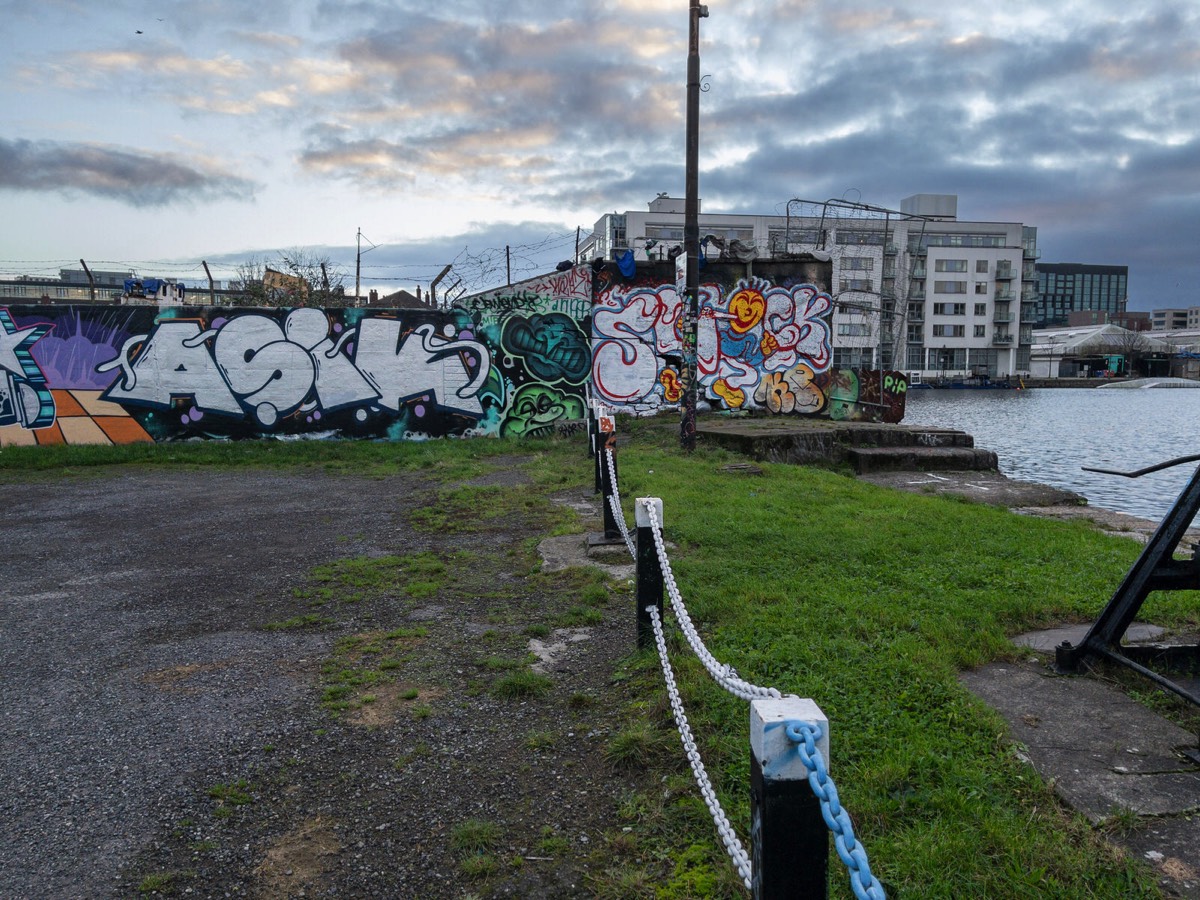
Commercial DisclosurePLEASE NOTE THAT LINKS BELOW MAY REDIRECT YOU TO THE AMAZON LOCATION MOST LIKELY TO SHIP TO YOUR ADDRESS
You will find links to buy products from Amazon, Google and other partners. If you click on these links, you’ll find that the URL includes a small extra piece of text which identifies that the click came from my websites. This text is an affiliate code, and it means that I get a small percentage of the money you spend if you choose to buy that product, or, in some cases, other products from the site soon after. These affiliate links help pay the costs of producing my websites and ensure that the content is free to you.

Sony NPFZ100 Z-series Rechargeable Battery Pack for Alpha A7 III, A7R III, A9 Digital Cameras
ORIGINAL SONY PRODUCT
About this item High capacity for long life, approx.2.2 times of the NP-FW50 Electrical capacity of 16.4Wh (7.2V/2280mAh). Dimensions (W × H × D): Approx. 38.7 x 22.7 x 51.7 mm (1.56 x 0.91 x 2.13) iNFOlithium enables remaining charge display on camera LCD screen. Weight: 3.0 ounces
EXPENSIVE BUT IT IS BEST TO AVOID THIRD PARTY BATTERIES