CHURCHES IN BELFAST
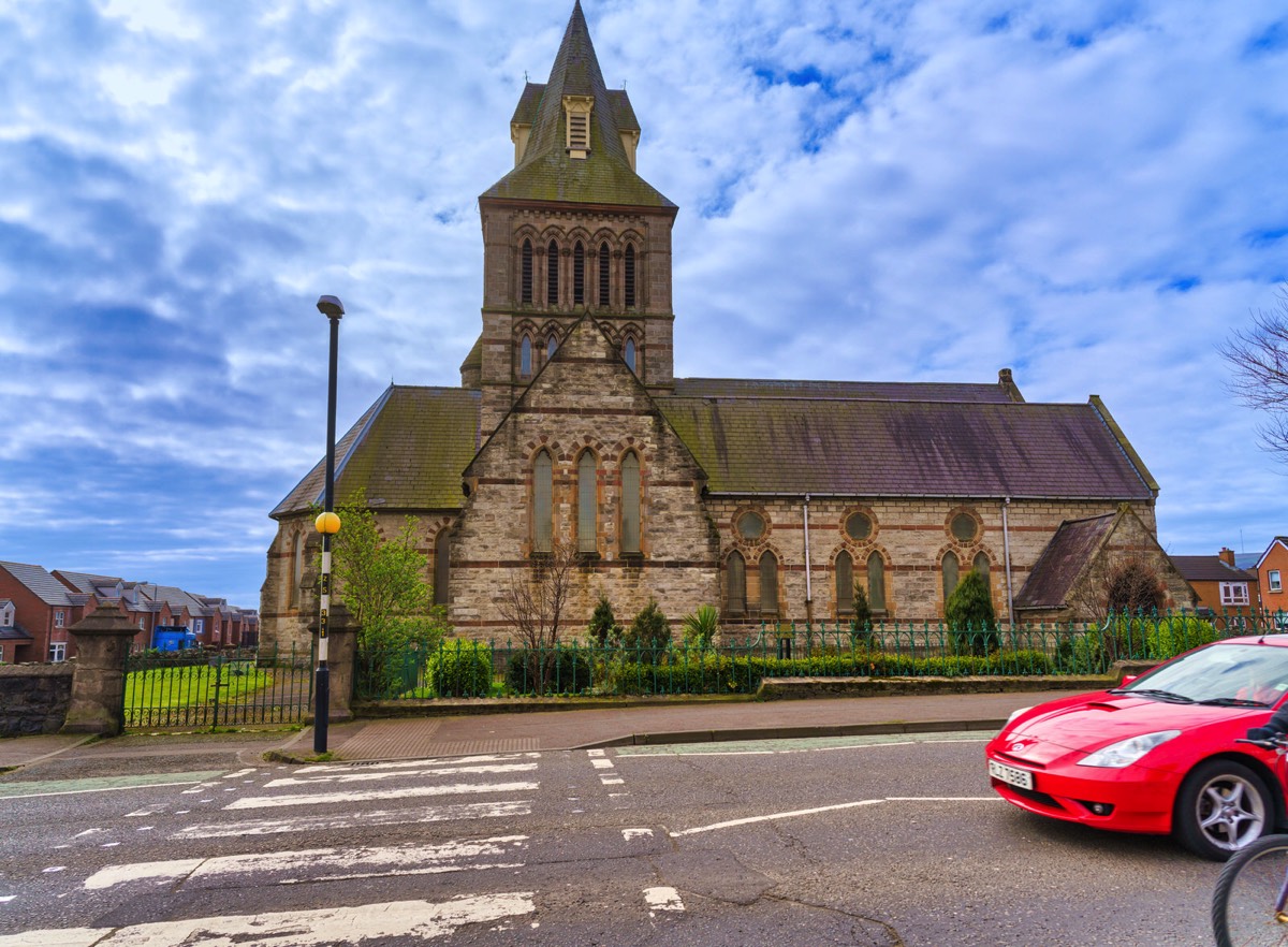
ST MARY'S CHURCH OF IRELAND CHURCH THE CRUMLIN ROAD MARCH 2019
This church was established in 1868. It was damaged during Blitz in 1941 and later restored.
St Mary’s Parish Church, Crumlin Road, Belfast, celebrated the 150th anniversary of its consecration with a Service of Thanksgiving on November 25 not long before my visit in March 2029.
St Mary’s Parish Church, Crumlin Road, Belfast, celebrated the 150th anniversary of its consecration with a Service of Thanksgiving on November 25 not long before my visit in March 2029.
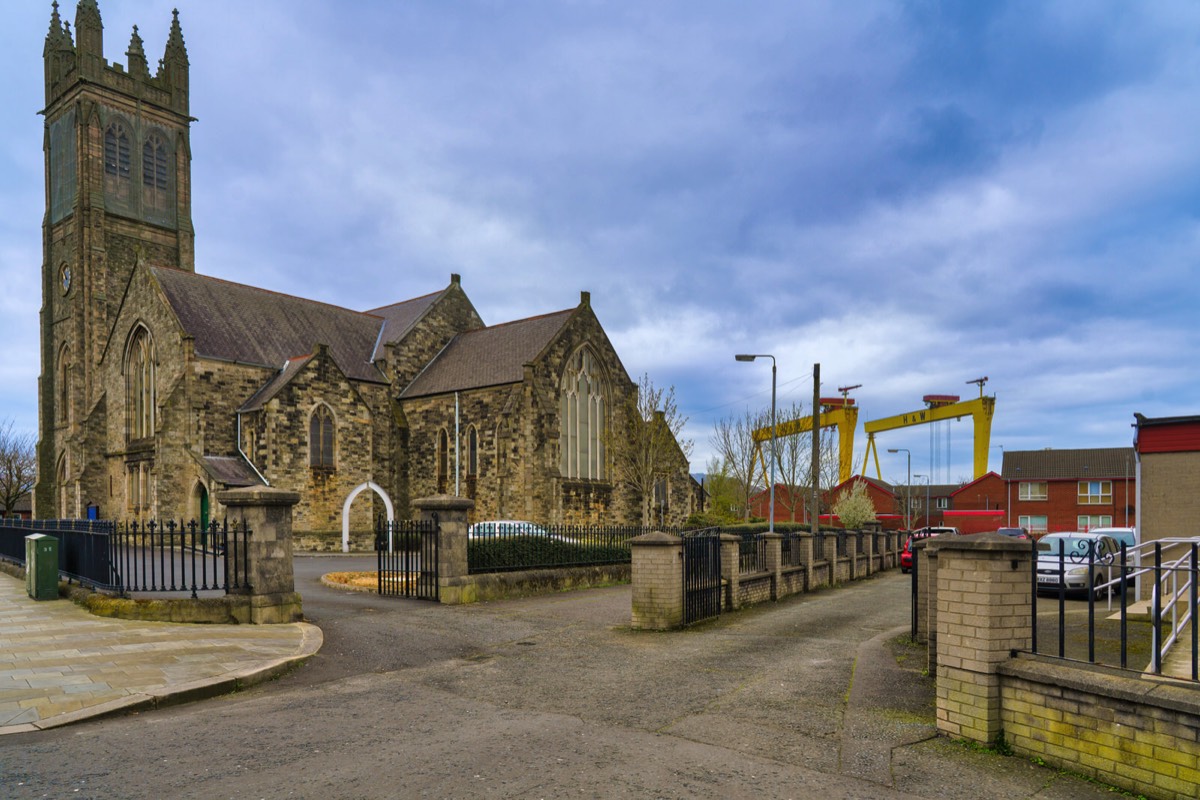
ST PATRICK'S BALLYMACARRETT CHURCH OF IRELAND PARISH CHURCH NEWTOWNARDS ROAD MARCH 2019
This image demonstrates just how much the Harland and Wolff cranes Samson & Goliath dominate the Belfast skyline.
According to contacts in Belfast the Newtownards Road is generally safe and well lit at night. One potential flashpoint is the interface with the nationalist Short Strand neighbourhood. Though fairly well kept and safe during the day, it is best to avoid this area at night.
According to a local that I had a chat with this large Church of Ireland Parish Church was rebuilt after the War to the original plans, having been destroyed in the Blitz.
Here is an extract from the churche's mission statement: Due to the extensive redevelopment and the ’Troubles', the demography of the area has changed enormously in recent years and is still grappling with regeneration. This may explain why I found the area to be more than a little bit confusing.
Ballymacarrett or Ballymacarret (from Irish Baile Mhic Gearóid 'MacGearóid's settlement') is the name of both a townland and electoral ward in Belfast. The townland is in County Down and the electoral ward is part of the Titanic district electoral area of Belfast City Council.
The ward was created in 1973 with most of the population coming from the former Pottinger ward. The ward was slightly enlarged in 1985, taking in part of the Island ward.
The ward consists of two distinct districts : Ballymacarrett itself, which is almost entirely Protestant, and the Short Strand which is almost entirely Catholic, with the two separated by a peaceline. Consequently, in the 2001 census, the Roman Catholic community background figure was 51%.
Set in the shadows of the Harland and Wolff cranes Samson & Goliath, large numbers of local men worked in the shipyard during its heyday. The area is also well known for 'Ulster's Freedom Corner', a series of loyalist murals.
Ballymacarrett and the nearby Newtownards Road played a key part in what became known as the 2011 Northern Ireland riots. At first, the riots were only located in the area and were known as the 2011 East Belfast riots but by July, the riots had spread to other parts of the region.
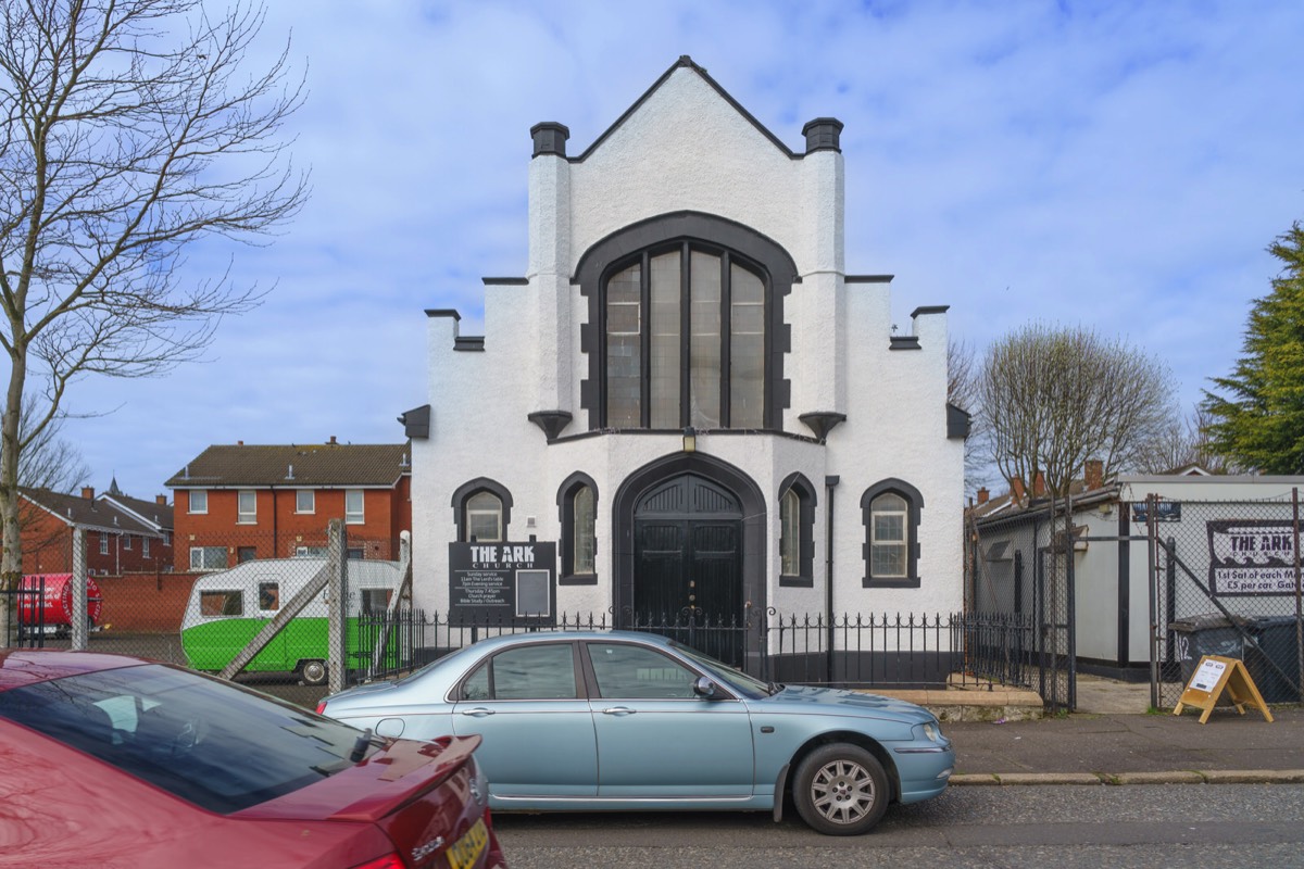
THE ARC CHURCH PHOTOGRAPHED IN MARCH 2019 PUBLISHED SEPTEMBER 2022
The number and variety of churches in Belfast never fails to surprise me.
In 1998, the Ulster History Circle unveiled a commemorative blue plaque to Chaim Herzog [who later went on to become President of Israel between 1983 and 1993] at his birthplace on Cliftonpark Avenue. The plaque was removed by the Circle from the building in August 2014, at the request of the Cliftonville Community Regeneration Forum, who are based there. The plaque had become the subject of unwelcome attention, and in the interests of health and safety it was taken away for safe keeping, until such time as it can be reinstated, with the consent of the owners and occupiers of the premises.
In 1998, the Ulster History Circle unveiled a commemorative blue plaque to Chaim Herzog [who later went on to become President of Israel between 1983 and 1993] at his birthplace on Cliftonpark Avenue. The plaque was removed by the Circle from the building in August 2014, at the request of the Cliftonville Community Regeneration Forum, who are based there. The plaque had become the subject of unwelcome attention, and in the interests of health and safety it was taken away for safe keeping, until such time as it can be reinstated, with the consent of the owners and occupiers of the premises.