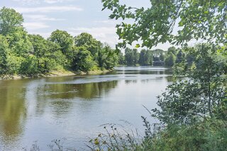
I TAKE A WALK ALONG THE STRANMILLIS EMBANKMENT - THE SECTION NEAREST ORMEAU BRIDGE
Stranmillis Embankment: Contrast at the River’s Edge
When most people speak of Stranmillis, they describe one of South Belfast’s most affluent, leafy, and prized quarters. It is an area defined by Queen’s University enclaves, Stranmillis University College, the Lyric Theatre, and the sprawling greenery of the Botanic Gardens. Yet, follow the River Lagan along Stranmillis Embankment towards its eastern terminus at the Ormeau Road, and the urban narrative undergoes a striking shift.
Here, where the riverfront meets the Ormeau Bridge, the polished suburban image of Stranmillis yields to a grittier, more layered visual landscape—one framed by weathered red-brick housing, tagged masonry, and dense graffiti.
The Dual Identity of Stranmillis
The name Stranmillis derives from the Irish an Sruthán Milis, meaning "the sweet stream"—a historical reference to the fresh waters of the River Lagan before reaching the tidal brackish stretch closer to the city centre. Granted to Sir Arthur Chichester in the early 17th century, the lands were initially enclosed as a 100-acre deer park for the Donegall estate before evolving into a landscape of gentlemanly demesnes and Victorian summer residences.
Throughout the late 19th and early 20th centuries, Stranmillis developed into an upscale residential and educational enclave. Grand Victorian and Edwardian villas were erected along Stranmillis Road and Malone, while the establishment of the teaching college in 1922 and the growth of Queen’s University cemented its reputation as a respectable, academic district.
However, Stranmillis is not a monolith. Its eastern flank is bounded entirely by the River Lagan, along which Stranmillis Embankment runs.
The Embankment Threshold: Where Stranmillis Meets Ormeau
While the southern end of the Embankment near Lockview Road connects to boat clubs, riverside cafes, and tree-lined avenues, the northern end closest to Ormeau Road operates as a complex urban boundary zone.
As the Embankment approaches the historic Ormeau Bridge—designed by Charles Lanyon and opened in 1863—it sits directly on the threshold between Stranmillis, the high-density student housing zones of the Holylands and Agincourt, and the Lower Ormeau Road.
This micro-geography accounts for the dramatic change in character:
Architectural Density & Rear Boundaries: Unlike the grand detached homes further up the ridge, this corner features dense Victorian terraced streetscapes, narrow lane entries, and long boundary walls facing the river path.
Transient Urban Fringe: Situated at the intersection of student rental zones and inner-city residential corridors, the area experiences high population turnover. Transient neighbourhoods often generate an informal street canvas—walls, gable ends, and rear property lines naturally attract graffiti, tagging, and informal street graphics.
Industrial & Social Transitions: Historically, the riverbanks near the Ormeau Bridge were working edges of the city, close to former brickworks, gasworks, and transport crossings. The lingering patina of this working-class, utilitarian riverfront contrasts sharply with the manicured gardens and suburban villas just half a mile upstream.
Documentary Observations
Photographing this stretch reveals a fascinating visual tension. On one side lies the natural, peaceful corridor of the Lagan Towpath; on the other, a heavily marked built environment reflecting raw urban expression and neglect.
Rather than detracting from the journey, this juxtaposition provides a grounded reminder of Belfast's block-by-block complexity. The contrast between Stranmillis’s reputation as an upmarket haven and the weathered, tagged brickwork at the Ormeau Road junction highlights how quickly an urban atmosphere transforms when geography, housing tenure, and public space intersect.
When most people speak of Stranmillis, they describe one of South Belfast’s most affluent, leafy, and prized quarters. It is an area defined by Queen’s University enclaves, Stranmillis University College, the Lyric Theatre, and the sprawling greenery of the Botanic Gardens. Yet, follow the River Lagan along Stranmillis Embankment towards its eastern terminus at the Ormeau Road, and the urban narrative undergoes a striking shift.
Here, where the riverfront meets the Ormeau Bridge, the polished suburban image of Stranmillis yields to a grittier, more layered visual landscape—one framed by weathered red-brick housing, tagged masonry, and dense graffiti.
The Dual Identity of Stranmillis
The name Stranmillis derives from the Irish an Sruthán Milis, meaning "the sweet stream"—a historical reference to the fresh waters of the River Lagan before reaching the tidal brackish stretch closer to the city centre. Granted to Sir Arthur Chichester in the early 17th century, the lands were initially enclosed as a 100-acre deer park for the Donegall estate before evolving into a landscape of gentlemanly demesnes and Victorian summer residences.
Throughout the late 19th and early 20th centuries, Stranmillis developed into an upscale residential and educational enclave. Grand Victorian and Edwardian villas were erected along Stranmillis Road and Malone, while the establishment of the teaching college in 1922 and the growth of Queen’s University cemented its reputation as a respectable, academic district.
However, Stranmillis is not a monolith. Its eastern flank is bounded entirely by the River Lagan, along which Stranmillis Embankment runs.
The Embankment Threshold: Where Stranmillis Meets Ormeau
While the southern end of the Embankment near Lockview Road connects to boat clubs, riverside cafes, and tree-lined avenues, the northern end closest to Ormeau Road operates as a complex urban boundary zone.
As the Embankment approaches the historic Ormeau Bridge—designed by Charles Lanyon and opened in 1863—it sits directly on the threshold between Stranmillis, the high-density student housing zones of the Holylands and Agincourt, and the Lower Ormeau Road.
This micro-geography accounts for the dramatic change in character:
Architectural Density & Rear Boundaries: Unlike the grand detached homes further up the ridge, this corner features dense Victorian terraced streetscapes, narrow lane entries, and long boundary walls facing the river path.
Transient Urban Fringe: Situated at the intersection of student rental zones and inner-city residential corridors, the area experiences high population turnover. Transient neighbourhoods often generate an informal street canvas—walls, gable ends, and rear property lines naturally attract graffiti, tagging, and informal street graphics.
Industrial & Social Transitions: Historically, the riverbanks near the Ormeau Bridge were working edges of the city, close to former brickworks, gasworks, and transport crossings. The lingering patina of this working-class, utilitarian riverfront contrasts sharply with the manicured gardens and suburban villas just half a mile upstream.
Documentary Observations
Photographing this stretch reveals a fascinating visual tension. On one side lies the natural, peaceful corridor of the Lagan Towpath; on the other, a heavily marked built environment reflecting raw urban expression and neglect.
Rather than detracting from the journey, this juxtaposition provides a grounded reminder of Belfast's block-by-block complexity. The contrast between Stranmillis’s reputation as an upmarket haven and the weathered, tagged brickwork at the Ormeau Road junction highlights how quickly an urban atmosphere transforms when geography, housing tenure, and public space intersect.
STRANMILLIS EMBANKMENT